Welcome to the nation’s capital! Whether you’re here for the cherry blossoms, the Smithsonian museums, or a business meeting on Capitol Hill, getting around D.C. can be a breeze—if you know the local secrets. Skip the $50 Uber rides and the headache of finding a parking spot in Georgetown. Let's get you moving like a local.

I. Understanding Public Transportation in Washington, D.C.
What Is WMATA and How DC Transit Works
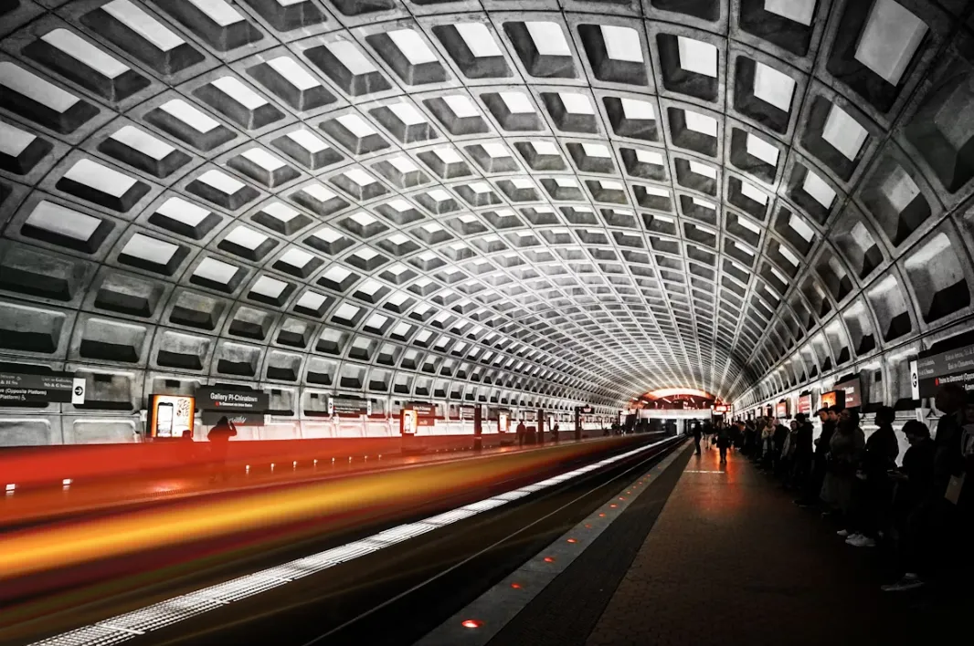
If you’re new to the area, you’ll quickly notice the big, brown "M" pylons dotting the street corners. This stands for the Washington Metropolitan Area Transit Authority, but we locals just call it WMATA or "Metro."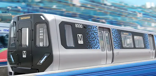
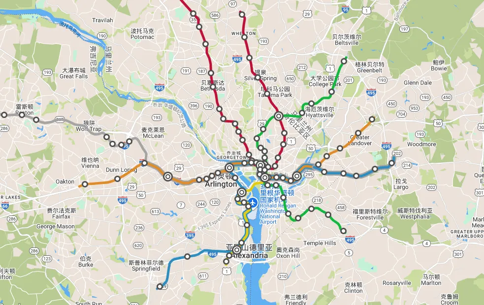
WMATA is a unique tri-jurisdictional agency. Unlike transit systems that stop at the city limits, D.C.'s network is a massive spiderweb covering Washington, D.C., and the surrounding suburbs in Maryland and Virginia (the DMV region). This means you can hop on a train in the heart of the city and end up in the rolling hills of Virginia or the bustling streets of Bethesda, MD, without ever changing systems.
Why Public Transportation Is the Best Way to Get Around DC
As a "helpful local friend," let me be honest: Do not bring a car into the District.
-
Heavy Traffic & Limited Parking: D.C. traffic is consistently ranked among the worst in the U.S. Parking near the National Mall is essentially a myth, and when you do find a garage, you might pay upwards of $30 for just a few hours.
-
Cost Savings: Between rental car fees, insurance, and the "Monument Parking Tax," driving is a money pit. A Metro ride is a fraction of the cost of a rideshare (Uber/Lyft) during surge pricing.
-
The "Doorstep" Factor: The Metrorail drops you literally at the doorstep of the Smithsonian museums, the Capitol Building, and vibrant neighborhoods like Adams Morgan or the Wharf.
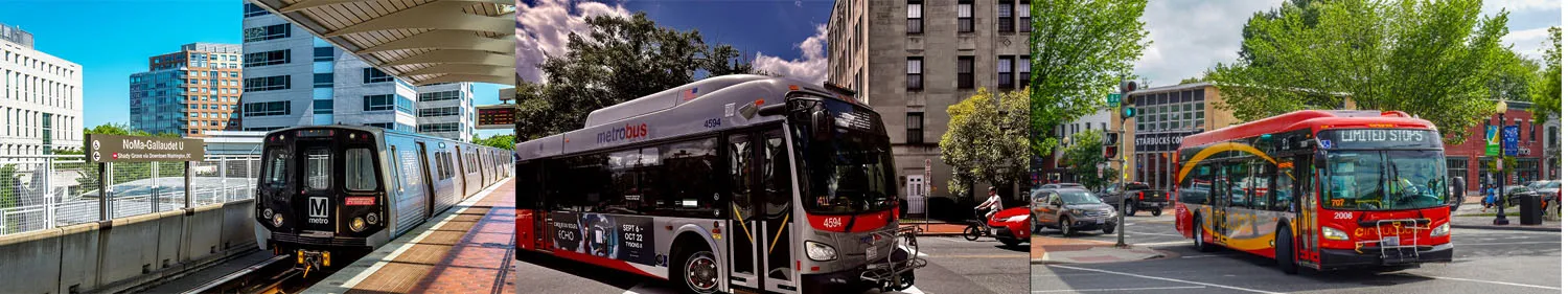
Metrorail, Metrobus, and DC Circulator Explained
Think of the transit system as three layers:
-
Metrorail: The heavy hitter. It’s the underground and elevated train system that moves people across long distances quickly.
-
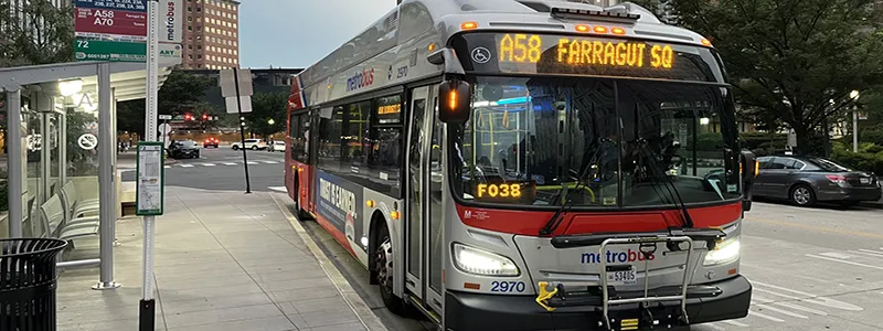
Metrobus: The regional workhorse. With over 300 routes, it reaches the nooks and crannies the train doesn't touch.
-
DC Circulator: Once a beloved fleet of easy-to-use red buses linking major areas like the National Mall, Union Station, and Georgetown — was phased out as of December 31, 2024.
II. Before You Ride DC Public Transportation (First-Time Visitor Guide)
DC Metro Service Hours and Late-Night Options
The Metro isn't 24/7, so timing is everything.
-
Typical Weekday Hours: 5:00 AM – 12:00 AM (Midnight).
-
Typical Weekend Hours: Friday 5:00 AM – 1:00 AM; Saturday 7:00 AM – 1:00 AM; Sunday 7:00 AM – 12:00 AM.
-
Late-Night Planning: If you're out late at a U Street jazz club or a bar in Navy Yard, keep an eye on the time. Once the last train leaves, your only options are the "Night Owl" bus routes or rideshare. Always check the WMATA website for the "Last Train" schedule for your specific station.
How to Use the DC Metro: Tap In, Tap Out Explained
This is where most first-timers get confused. D.C. uses a closed-gate system based on distance.
-
The Tap In: You must tap your SmarTrip card or phone at the faregate to enter the station. This "checks you in" and records your starting point.
-
The Tap Out: You must tap again to exit your destination station. This is when the system calculates the distance traveled and deducts the correct fare.
 Image from WMATA, Copyright by original author
 -
Forgot to Tap Out? If you follow someone through a gate or the gate is open and you don't tap, the system won't know where you ended your trip. The next time you try to enter, your card might be "locked" or charged the maximum possible fare. If this happens, see the Station Manager in the kiosk immediately.
First-Time Rider Checklist for Washington, D.C.
Before you leave your hotel or the airport, run through this list:
-
SmarTrip Set Up: Do you have it in your Apple Wallet/Google Pay or a physical card in hand? (See Chapter III for how to do this).
-
Transit App Downloaded: While Google Maps is great, an app like Citymapper or the DC Metro and Bus app provides better real-time data on train frequency.
-
Identify Your Destination: Don't just know the museum name; know the station name and the color of the line (e.g., "Smithsonian Station on the Blue/Orange/Silver lines").
III. How to Pay for DC Metro and Buses Using SmarTrip®
Digital First: Your Phone is Your Ticket
In 2026, the days of fumbling for change or paper tickets are long gone. The SmarTrip® app and integration with mobile wallets have made travel seamless.
① Apple Wallet & Google Pay: You can add a virtual SmarTrip® card directly to your mobile wallet. You don’t even need to open an app or unlock your phone—just "Tap and Go" at the fare gates. [SmarTrip on iPhone & Apple Watch] [SmarTrip on Android & Google Wallet]
Supported Transit: Use this for Metrorail, Metrobus, and regional bus systems like ART (Arlington), DASH (Alexandria), and Fairfax Connector.

② The SmarTrip® App (Your Command Center): 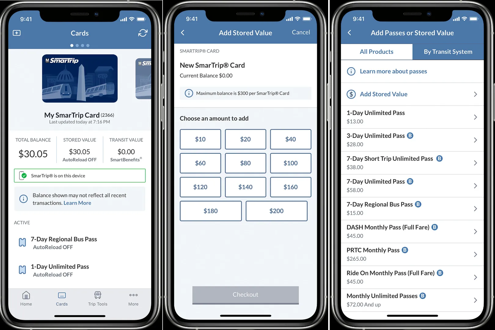 For the best experience, download the official SmarTrip® App. While your mobile wallet handles the "tap," the app is where you manage your transit life. You can check your real-time balance, set up "Auto-Reload" so you never run out of funds, and purchase money-saving Unlimited Passes directly on your phone. If you have an old physical card, you can also use the app to transfer its balance to your mobile wallet instantly. [Download on the Apple Store] [Download on Google Play]
Supported Transit: Full management for Metrorail and Metrobus funds/passes; also tracks balances used for regional buses and Metro-operated parking garages.
③ Tap. Ride. Go. (NEW for 2026): For ultimate convenience, no need to sign up, register, or purchase a SmarTrip card. WMATA now supports direct contactless payment. Simply tap your physical credit/debit card, or the card already in your Apple/Google Wallet, at any faregate or bus reader. No app to download, no balance to reload—just tap and ride.
Supported Transit: Currently accepted on Metrorail and Metrobus. Note: Contactless bank cards may not yet be supported on some smaller regional suburban bus lines or for purchasing specific multi-day passes.
Express Mode: For iPhone users, ensure "Express Transit" is turned on so you can pay even if your phone’s battery is critically low.
Why go digital? It’s free to create a new card via the app (saving you the $2 physical card fee), and you can set up "Auto-Reload" so you’re never stuck at a gate with a low balance.
Physical Cards: The Reliable Backup
If you're a fan of tangible souvenirs or traveling with children who don't have phones, the plastic SmarTrip® card is still a staple.
Where to Buy: Every Metro station has several blue vending machines. They accept credit cards and cash.
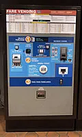
The $2 Fee: Note that a new physical card costs $2 plus whatever fare you choose to load.
Registration: Pro tip—register your physical card on the WMATA website. If you lose it, you can transfer your remaining balance to a new card. Without registration, that money is gone!
2026 Metrorail Fare Guide: How Much Will It Cost?
Transit pricing depends on the mode of transport, the distance traveled (for rail), and the time of day. Here is a breakdown of standard fares and the various Unlimited Passes available for tourists and commuters:
|
Category |
Fare Type |
Price (Approx.) |
Notes |
|---|---|---|---|
|
Metrorail |
One-Way: Peak |
$2.25 – $6.75 |
Weekday (5:00 a.m. - 9:30 p.m.) |
|
One-Way: Off-Peak |
$2.25 – $2.50 |
Weekday (After 9:30 p.m.) |
|
|
Metrobus |
Standard Route |
$2.25 |
Use SmarTrip or Contactless |
|
Express Route |
$4.80 |
For long-distance commuter routes |
|
|
Unlimited Passes (Metrorail & Metrobus) |
1-Day Unlimited |
$13.50 |
Includes Rail & standard Metrobus |
|
3-Day Unlimited |
$33.75 |
Perfect for a long weekend visit |
|
|
7-Day Short-Trip |
$40.50 |
Rail up to $3.85 + standard Metrobus |
|
|
7-Day Unlimited |
$60.75 |
Best for long-distance commuters |
|
|
Monthly Unlimited Pass |
$72.00 - $216.00 |
Long-time use |
Transfers Discount - SmarTrip and Tap.Ride.Go.
- Metrobus to Metrobus: Free, unlimited transfers within a 2-hour period
- Metrobus to Metrorail/Metrorail to Metrobus: Free transfers ($2.25 discount) within a 2-hour period. $2.25 discount does not cover the cost of transferring to/from express routes. SmarTrip card required.
- Farragut Crossing: Free transfer between the Red line and Orange, Silver and Blue lines by exiting and entering through Farragut West and Farragut North
Choosing the Right 7-Day Pass
If you are staying for a full week, choosing the right pass depends on your expected travel distance:
-
7-Day Short-Trip Pass ($40.50): This covers any trip costing up to $3.85. Since most trips between major tourist spots downtown (like Smithsonian to Dupont Circle) fall under this price, it’s usually enough. If you take a longer trip (e.g., to Dulles Airport), you simply pay the small difference from your card balance.
-
7-Day Unlimited Pass ($60.75): This covers every single trip regardless of distance or time of day. If you are staying far out in the suburbs (Maryland/Virginia) and commuting into the city daily, this pass provides the best value and peace of mind.
Senior, Student & Disability Discounts
-
Reduced Fares: Seniors (65+), people with disabilities, and K-12 students in D.C. are eligible for 50% off standard fares.
-
How to get them: These are not available at standard vending machines. You must visit a designated sales office (like Metro Center) with a valid ID to obtain a specially encoded card.
IV. How to Ride the Washington, D.C. Metro (Metrorail Guide)
Understanding the 6 Color-Coded Lines
The Metrorail system is organized into six color-coded lines. Each serves a specific part of the DMV region:
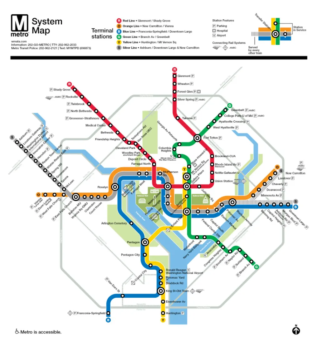
Red Line (Glenmont / Shady Grove): The system's workhorse and the only line that doesn't share tracks with others. It forms a giant "U" shape, connecting Montgomery County, MD, through downtown DC, and back out to eastern MD.
Blue Line (Franconia-Springfield / Downtown Largo): Connects Fairfax County, VA, through DCA Airport and downtown DC, eventually heading east to Prince George's County, MD. It shares significant trackage with the Orange and Silver lines.
Orange Line (New Carrollton / Vienna): Runs from Vienna, VA, through the heart of the District, and ends in New Carrollton, MD. It is a major commuter artery for Northern Virginia.
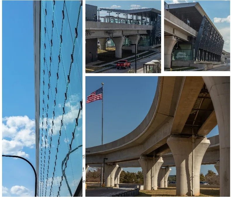
Silver Line (Ashburn / Downtown Largo & New Carrollton): The newest addition, providing a direct link from Dulles International Airport (IAD) and the tech corridor of Reston/Tysons through downtown DC to Maryland.
Yellow Line (Huntington / Mt Vernon Sq): Provides a fast North-South connection between Huntington, VA, DCA Airport, and the vibrant neighborhoods of Shaw and Howard University in DC.
Green Line (Branch Av / Greenbelt): Runs North-South from Branch Ave, MD, through the waterfront at Navy Yard and the nightlife hubs of U Street and Columbia Heights, ending in Greenbelt, MD.
Popular Routes for Sightseeing
If you are visiting the District, these are the routes you will likely use the most:
-
The "Museum Hop" (Blue/Orange/Silver): Most of the Smithsonian museums are clustered along these three lines. Use the Smithsonian station for the Air and Space Museum or Natural History Museum, and L'Enfant Plaza for the Spy Museum and the Wharf.
-
The "Nightlife & Dining" Route (Green/Yellow): Take the Green or Yellow lines to U St/African-Amer Civil War Memorial/Cardozo for D.C.'s best jazz clubs and bars, or Navy Yard-Ballpark for a Nationals baseball game and waterfront dining.
-
The "Zoo & Neighborhoods" Route (Red): The Red Line is your gateway to the Woodley Park-Zoo station (National Zoo) and the trendy shops of Dupont Circle.
Reading the Pylon: Finding Your Direction
Here’s the local secret: DC Metro doesn't use "Northbound" or "Southbound." Instead, they use the End-of-Line Station as the direction.
-
The Trick: Look at the map. If you want to go to the National Zoo (Woodley Park Station) from downtown on the Red Line, you need the train heading toward Shady Grove. If you want to go toward Union Station, you need the train heading toward Glenmont.
-
The Platform Pillars: Every platform has a brown pillar (pylon) listing every stop in the direction the train is traveling. If your destination isn't on that list, you’re on the wrong side of the track!
Service Hours & Frequency
Understanding when the trains run is critical for a smooth trip. Metrorail operating hours differ between weekdays and weekends.
-
Standard Operating Hours:
-
Monday – Thursday: 5:00 AM – 12:00 AM
-
Friday: 5:00 AM – 1:00 AM
-
Saturday: 7:00 AM – 1:00 AM
-
Sunday: 7:00 AM – 12:00 AM
-
-
Frequency (How often do trains come?):
-
Peak Hours: During weekday rush hours, trains on most lines arrive every 8–12 minutes. In core downtown areas where lines overlap, you may see a train every 3–5 minutes.
-
Off-Peak & Weekends: Trains typically arrive every 12–15 minutes. During late-night hours or major track work, wait times can increase to 20 minutes or more.
-
-
Important Note: Always verify the latest schedule on the official WMATA website (wmata.com) before your trip. Service may end earlier or have significantly reduced frequency during holidays or scheduled maintenance weekends.
-
Recommended Tools for Real-Time Arrival:
-
Citymapper: Provides the most accurate "live" countdowns for trains.
-
Google Maps: Great for integrated route planning.
-
MetroHero (or WMATA’s MetroPulse): Specialized tools to see exactly where trains are on the tracks.
-
The "Standing Rules" and Etiquette
If you want to blend in and avoid a lecture from a grumpy commuter, remember these:
-
"Stand Right, Walk Left": On the long, deep escalators (like the one at Wheaton—the longest in the Western Hemisphere!), stay on the right side if you're standing. The left lane is reserved for the "power walkers."
-
Let Them Out First: Stand to the side of the train doors to let arriving passengers exit before you try to rush in.
-
Move to the Center: Don't congregate by the doors once you're inside. Move to the middle of the car to make room for others.
-
No Food or Drink: Seriously. DC Metro is famous for its clean, brutalist stations because eating and drinking are strictly banned. You can be fined for even having an open coffee cup.
Safety and Accessibility
-
Platform Safety: Stay behind the bumpy granite strip. When a train is approaching, the lights on the edge of the platform will flash.
-
Elevators: Every station has an elevator, but with the system’s age, they sometimes break down. Always check the "Elevator Status" on the WMATA homepage or use an app if you have mobility needs.
-
Station Managers: If you lose something or your card doesn't work, head to the brown kiosk near the fare gates. The Station Manager is there to help!
Navigating the Big Transfer Hubs
There are several major stations where lines intersect. The "Big Three" are:
-
Metro Center: Transfer between Red, Blue, Orange, and Silver.
-
L'Enfant Plaza: The ultimate hub—transfer between Blue, Orange, Silver, Green, and Yellow.
-
Gallery Place-Chinatown: Transfer between Red, Green, and Yellow.
-
Local Tip: These stations have multiple levels. Follow the overhead signs. Red Line is usually on its own level, while the others share platforms.
V. Getting Around DC by Bus: The Metrobus System
D.C.'s bus network is a comprehensive system designed to complement the Metrorail, ensuring every neighborhood is accessible. Whether you're commuting to work or exploring hidden local gems, the bus offers a flexible and scenic way to navigate the city.
Using Unlimited Passes on Buses
If you have already purchased a Metrorail Unlimited Pass (1-Day, 3-Day, 7-Day Unlimited, or Monthly), you do not need to pay extra for the bus!
-
Unlimited Inclusion: All Unlimited Passes (except the 7-Day Short-Trip Pass) include unlimited rides on all regular Metrobuses. Just tap the same SmarTrip card or phone you use for the Metro when you board the bus.
-
The Short-Trip Exception: The 7-Day Short-Trip Pass is primarily designed for rail travel. While it can be used on buses, it does not provide the same "unlimited" free bus travel benefit as the full Unlimited Pass.
Metrobus: The Neighborhood Connector
[Check new MetroBus Routes and Timetables]
[Washington, DC Metrobus Route Profiles]
[Maryland Metrobus Route Profiles]
[Virginia Metrobus Route Profiles]
While the Metro trains are great for long distances, the Metrobus system is what truly connects D.C.'s diverse neighborhoods. With over 300 routes, it can feel intimidating, but here’s how to master it:
-
Decoding the Route Numbers: Most bus routes are named with a letter and a number (e.g., the 38B or the S2).
-
Local Tip: The 30-series buses (like the 32, 33, and 36) are legendary because they run along Pennsylvania Avenue, connecting the National Mall to Georgetown.
-
-
Standard vs. Express Routes:
-
Standard Routes: These have frequent stops and cost the base fare of $2.00. They are perfect for short hops between neighborhoods.
-
Express Routes (e.g., the "S" or "X" lines): Identified by their route numbers and often premium branding, these routes serve long-distance commuters with fewer stops. Note that Express Routes have a higher flat fare of $4.25. If you are a visitor, you likely won't need these unless you are staying deep in the suburbs.
-
-
Payment is "Tap Only": You cannot pay with cash on D.C. buses anymore. You must tap your SmarTrip card or phone on the reader at the front door when boarding. There is no need to "tap out" on the bus; it's a flat fare ($2.25 for standard routes).
-
Real-Time Tracking: Bus schedules are more like "suggestions" due to traffic. Always use an app like Transit or the WMATA NextBus tool to see exactly where your bus is.
-
Requesting a Stop: Pull the yellow cord or press the red "Stop" button before your stop. If you're unsure, just ask the driver—they’re usually happy to give you a shout when you reach your destination.
The "Free Transfer" Strategy
D.C. has one of the most generous transfer policies in the U.S.
-
Bus to Bus: Transfers between any Metrobus route are free within a 2-hour window.
-
Rail to Bus: If you start on the Metro train and then hop on a bus, your bus fare is free (standard routes).
-
The Catch: You must use the same SmarTrip card or mobile wallet for both legs of the trip to trigger the discount automatically.
VI. Washington, D.C. Airport Transportation by Public Transit
Navigating the airports in the D.C. area doesn't have to be expensive. Depending on where you land, the Metro can be your fastest and cheapest option.
DCA: Ronald Reagan Washington National Airport
This is by far the easiest airport for public transit. It’s located just across the Potomac River from downtown D.C.
-
Direct Metro Access: The Blue and Yellow Lines have a station built directly into the airport.
-
Finding the Station: Follow the "Metrorail" signs from any terminal. It’s a short walk (5-10 minutes) via covered pedestrian walkways.
-
Cost & Time: A trip to the National Mall takes about 15-20 minutes and costs between $2.25 and $3.50 depending on the time of day.
-
Pro Tip: DCA is so close that you can see the monuments from the plane! It's the preferred airport for locals.
IAD: Dulles International Airport
Located about 26 miles west of D.C., Dulles used to be a headache to reach. Not anymore!
-
The Silver Line Extension: The Silver Line now runs all the way to Dulles.
-
Finding the Station: The station is connected to the main terminal via an indoor tunnel with moving walkways (about a 5-8 minute walk from baggage claim).
-
Cost & Time: The ride to downtown D.C. (Metro Center) takes about 55-60 minutes. Fares range from $3.85 to $6.00.
-
Luggage Tip: Silver Line trains are usually newer and have a bit more space, but there are no dedicated luggage racks. Be prepared to keep your bags close to your seat.
BWI: Baltimore/Washington International Thurgood Marshall Airport
BWI is technically in Baltimore, but it’s a popular choice for budget travelers. Metro does not go here, but there are two solid rail options from Union Station:
-
MARC Train (Penn Line): This is the commuter rail and the cheapest option ($9.00 one-way). It runs frequently on weekdays and has limited weekend service.
-
Amtrak: Faster and more comfortable, but more expensive (prices vary from $15 to $40+).
-
Getting to the Train Station: From the BWI terminal, hop on the free shuttle bus to the "BWI Rail Station." It runs every 10-15 minutes and takes about 10 minutes to reach the platform.
Comparison: Which Airport Should You Choose?
|
Feature |
DCA (Reagan) |
IAD (Dulles) |
BWI (Baltimore) |
|---|---|---|---|
|
Distance to DC |
4 miles |
26 miles |
32 miles |
|
Primary Transit |
Metrorail (Blue/Yellow) |
Metrorail (Silver) |
MARC/Amtrak Train |
|
Travel Time |
15-20 mins |
55-65 mins |
45-60 mins |
|
Cost (approx.) |
$2 - $4 |
$4 - $6 |
$9 - $30 |
|
Convenience |
★★★★★ |
★★★★☆ |
★★★☆☆ |
VII. Biking and Scooters in Washington, D.C.
For trips that are "too far to walk but too close for the Metro," D.C.'s micro-mobility options are world-class. The city is very flat near the monuments, making wheels a perfect choice.
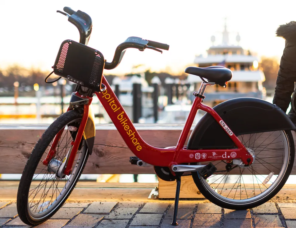
Capital Bikeshare (The Red Bikes)
Capital Bikeshare (CaBi) is the local bike-share system with over 600 stations across the DMV.
-
Pricing Options:
-
Single Ride: $1.00 to unlock + $0.05/min (Classic) or $0.15/min (Electric). Great for a quick dash.
-
24-Hour Pass: ~$8.00. Includes unlimited 30-minute rides on Classic bikes. If you keep a bike longer than 30 mins, you pay a per-minute fee.
-
-
Classic vs. EBikes: Classic bikes are red and manual. EBikes (black) have pedal-assist, which is great for the hilly climb up to National Cathedral or Adams Morgan.
Electric Scooters (Lime, Spin, Lyft)
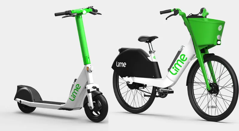
Scooters are everywhere in D.C. and operate on a "dockless" model.
-
How to Ride: Download the respective app, scan the QR code on the handlebars, and you're off.
-
Sidewalk Restrictions: It is illegal to ride scooters on the sidewalks in the "Central Business District" (basically the high-foot-traffic area need the White House and National Mall). Look for signs or app notifications. Stick to the bike lanes!
The "No-Ride Zones" & National Mall Safety
The National Mall is a federal park, and rules are slightly different there:
-
Gravel Paths: Riding on the fine gravel paths is allowed but can be slippery. Stick to the paved paths when possible.
-
No-Go Zones: You cannot ride bikes or scooters inside the actual memorials (e.g., inside the Lincoln Memorial or the Vietnam Veterans Memorial). Park your wheels at the designated racks nearby and walk in.
VIII. DC Public Transportation Tips for Tourists and Visitors
Best Apps for Navigating Washington, D.C. Transit
Don't rely solely on paper maps. These three digital tools are essential:
-
Google Maps: Excellent for general point-to-point directions and identifying which line to take.
-
Citymapper: The local favorite. It provides more detailed walking directions inside complex stations and tells you which end of the train to board for the fastest exit.
-
WMATA Website & Tools: Use the official Trip Planner and check Real-Time Arrivals (especially for buses). Bookmark the Elevator Status page if you are traveling with a stroller or wheelchair.
Weekend Metro Closures and Service Advisories
The biggest "gotcha" for visitors is weekend track work.
-
The Problem: WMATA often closes entire station segments or implements "single-tracking" (trains sharing one track) on Saturdays and Sundays for repairs.
-
The Solution: Always check the "Service Advisories" section on wmata.com on Friday night. If your station is closed, look for the Free Shuttle Bus signs outside the station—they will take you to the next open stop.
Accessibility on DC Metro (ADA, Elevators, and Ramps)
D.C. has one of the most accessible transit systems in the world.
-
Every Station Has an Elevator: Unlike older systems (like NYC), every single DC Metro station is equipped with elevators.
-
Bridge Plates: If the gap between the platform and the train is too wide, the train operator can provide a ramp upon request.
Safety Tips for Riding Public Transportation in DC
-
Station Awareness: Stations are well-lit and monitored by CCTV. However, always stay behind the granite platform edge.
-
Emergency Contact: If you see something suspicious or need help, you can text the Metro Transit Police Department (MTPD) at MyMTPD (696873). This is often faster and more discreet than calling.
Late-Night Transportation Options
Since the Metro closes at midnight (or 1 AM on weekends), you need a Plan B for late-night fun.
-
Night Owl Buses: Some bus routes run 24 hours (like the S2 or 16th Street routes), but they are infrequent.
Common DC Metro Mistakes Tourists Should Avoid
-
Standing on the Left Side of Escalators: This is the ultimate "tourist move." Stand on the right, walk on the left. D.C. commuters are in a rush and will not be happy if you block the left side with your luggage.
-
Boarding the Wrong Branch: Lines like the Orange/Silver/Blue share tracks. Look at the destination sign on the front and side of the train before stepping on.
-
Assuming Buses Accept Cash: Most D.C. buses are now cash-free. Always have your SmarTrip card ready before the bus pulls up.
-
Underestimating the National Mall: The "Smithsonian" Metro station is in the middle of the Mall, but walking from the Capitol to the Lincoln Memorial is over 2 miles. Use the Metrobus system or a Bikeshare to bridge the gap!
IX. Sample One-Day "Classic DC" Itinerary
Want to see the best of DC without ever touching a steering wheel? Follow this high-efficiency transport plan.
|
Time of Day |
Starting Point |
Destination |
Transportation Mode |
Key Details |
|---|---|---|---|---|
|
Morning |
Union Station |
U.S. Capitol |
Metrorail Red Line |
Board towards Shady Grove. Exit at Union Station or Judiciary Square. |
|
Mid-Day |
U.S. Capitol |
Smithsonian Museums |
Metrobus National Mall Route |
Use the stop near the Capitol. Exit at 12th St & Jefferson Dr SW. |
|
Afternoon |
Museums |
Lincoln Memorial |
Metrobus National Mall Route |
Head West. Explore Lincoln, Vietnam, and Korean War memorials. |
|
Evening |
Lincoln Memorial |
Georgetown |
Metrorail + Metrobus |
Walk to Foggy Bottom Station. Take Blue/Orange/Silver Line East to Farragut West. Transfer to Metrobus Georgetown Line at K & 17th St. |
|
Night |
Georgetown |
Union Station / Hotel |
Metrobus Georgetown-Union Station Route |
Head East. This line goes directly back to Union Station or downtown hotels. |
X. Conclusion
You're all set! D.C. is a beautiful, walkable city, and the transit system is your best friend for exploring every corner of it.
Quick Travel Checklist before you leave the hotel:
-
SmarTrip loaded on your phone?
-
Maps downloaded for offline use?
-
Service alerts checked for weekend work?
-
Comfortable walking shoes on?
Have an amazing time in D.C., and we’ll see you on the platform!