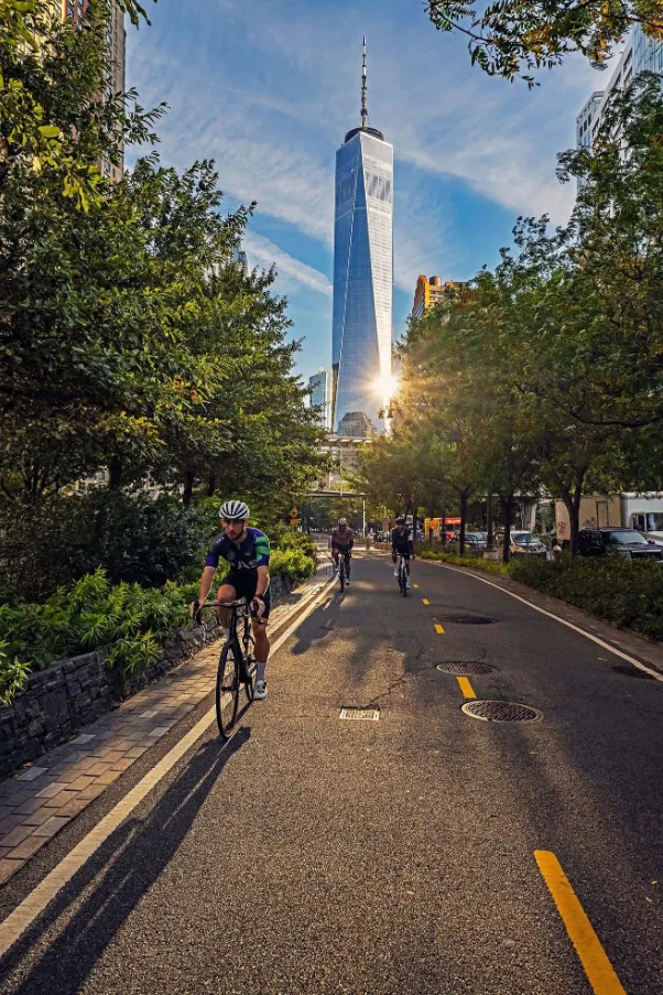
2026 is not just another year on the calendar; it is a historic milestone for North American cycling. As the United States celebrates its Semiquincentennial (250th Anniversary), the nation has transformed into a world-class cycling destination.
-
The Semiquincentennial Milestone: Beyond the fireworks, 2026 offers a "Cultural Pedaling" movement. Cycling has emerged as the premier way to experience local festivities, allowing travelers to bypass the gridlock of massive automotive parades.
-
Infrastructure Breakthrough: This year marks the definitive completion of critical connectors in the U.S. Bicycle Route System (USBRS). A seamless, safer grid now links state lines, turning what used to be fragmented paths into a unified national treasure.
-
The E-Bike Revolution: With widespread charging networks now standard in National Parks and "Bike Hubs" in rural small towns, long-distance touring has been democratized for riders of all fitness levels.
I. Essential Knowledge: Survival & Etiquette on American Roads
In the U.S., a bicycle is legally classified as a vehicle. This means you have the same rights—and the same responsibilities—as a motorist. To navigate the 2026 landscape safely, you must master the "Social Contract" of the road.
1. Rules of the Road: Defensive Riding & Legalities
-
The "STOP" Sign Protocol: This is the most common pitfall for international travelers. Unless you are in a state that has officially adopted the "Idaho Stop" (treating stops as yields), you must perform a full foot-down stop at every red octagonal sign. In 2026, local authorities in festival zones are strictly enforcing this, with fines reaching up to $150.
-
"Taking the Lane": Do not hug the gutter. If a shoulder is narrow, debris-filled, or unsafe, you have the legal right to ride in the center of the lane. This is called "Taking the Lane," and it discourages motorists from making dangerous, "close-pass" overtakes.
-
The "Two-Stage" Left Turn: For busy multi-lane intersections, we recommend the "Box Turn." Ride straight across the intersection to the far right corner, pivot your bike, and wait for the green light in the new direction. It is slower, but infinitely safer.
2. 2026 E-Bike Classification (The Three-Class System)
Understanding the "Class" of your e-bike is crucial for legal trail access in 2026:
-
Class 1 (Pedal Assist, 20mph): The "Universal Key." These are allowed on almost all multi-use paths and Rail-Trails.
-
Class 2 (Throttle, 20mph): Often restricted in "Wilderness" designated areas. If your bike has a throttle, double-check local ordinances.
-
Class 3 (Speed Pedelec, 28mph): Due to their high speed, Class 3 bikes are increasingly restricted to the roadway and are prohibited from many paved greenways like the Empire State Trail.
II. The 10 Epic Routes: From Coastal Dreams to High-Altitude Mastery
Choosing a route in 2026 is about more than mileage; it’s about finding a "Soul Resonance." Here are the ten most iconic corridors for the 250th Anniversary.
1. Highway 1, California: The Pacific Roar & Sequoia Silence
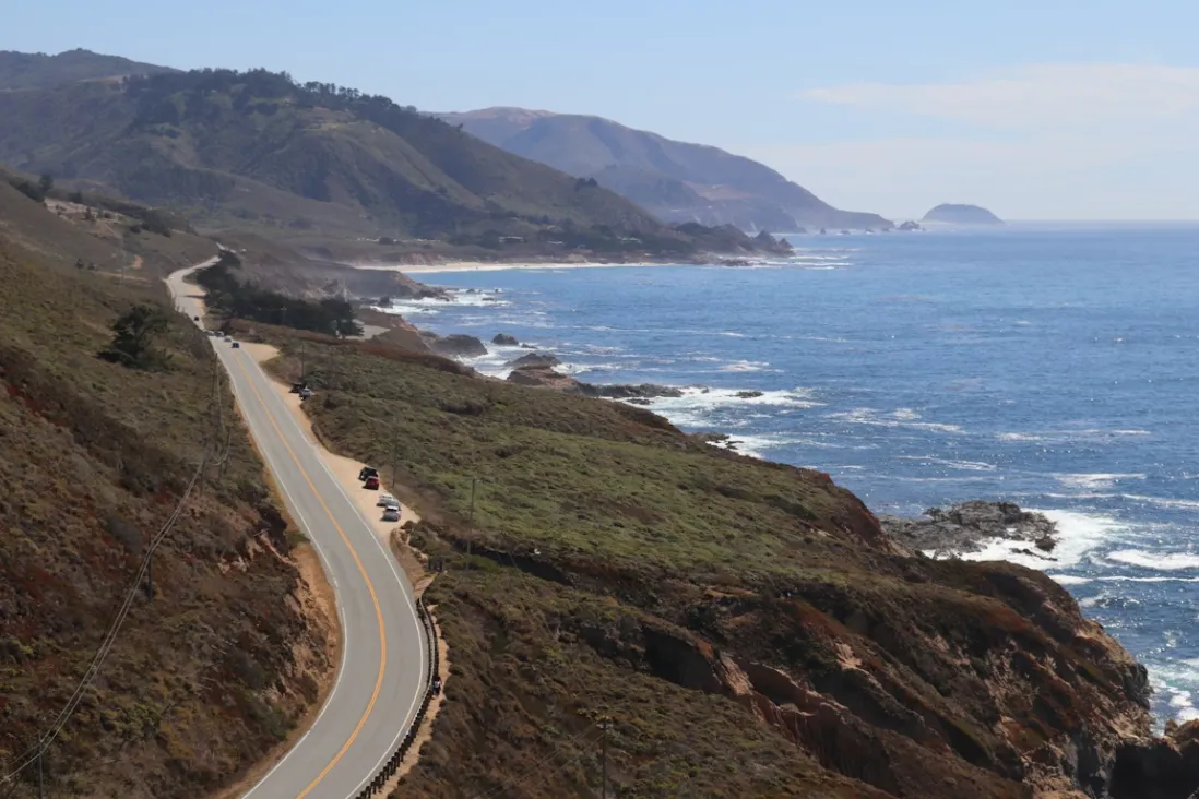
"An essential rite of passage for every cyclist on Earth."
-
Overview: Stretching from the misty cliffs of San Francisco down to the sun-drenched beaches of San Diego, this route is the crown jewel of American coastal cycling. It weaves together the sheer vertical drama of Big Sur, the historic charm of Monterey, and the ancient giants of the Redwood groves.
-
The Vibe: Stretching from San Francisco to San Diego, this is the pinnacle of coastal riding.
-
Total Distance: Approximately 600 miles (965 km).
-
Physical Address: Bixby Creek Bridge, CA-1, Monterey, CA 93940.
-
Recommended Bike: Lightweight Road Bike / Endurance Road Bike (28c+ tires).
-
Highlight Segment: Big Sur (Carmel to San Simeon) — 90 miles of dramatic cliffs and pristine ocean views.
-
Pro Tip: Ride North to South. This keeps you on the ocean side for unobstructed views and easy pull-offs for photos.
-
Best For: Landscape worshippers, ocean-air addicts, and those who want to tick off the #1 bucket-list ride in America.
| Category | Details | Editor’s Notes |
|---|---|---|
| Difficulty Level | ★★★★☆ | Significant elevation changes throughout the route, with strong crosswinds in the Big Sur section. Best suited for riders with long-distance touring or bikepacking experience. |
| Best Season | September – October | Avoid the heavy coastal fog common in summer (June–August), often referred to locally as “May Gray” and “June Gloom.” Fall typically offers the clearest ocean views. |
| Road Surface | 100% Paved | Fully paved roads throughout the route. 28c–32c puncture-resistant tires are recommended to handle occasional roadside debris and gravel. |
| 2026 Status | Fully Open | New bike-in campsites have been added along parts of the route in 2026. Advance reservations are strongly recommended during peak travel periods. |
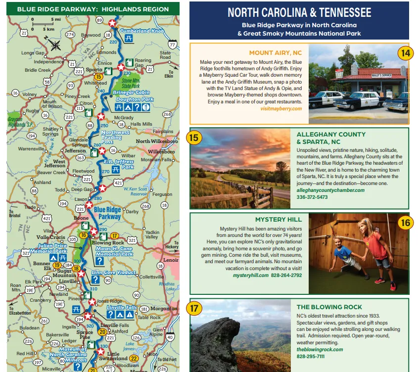
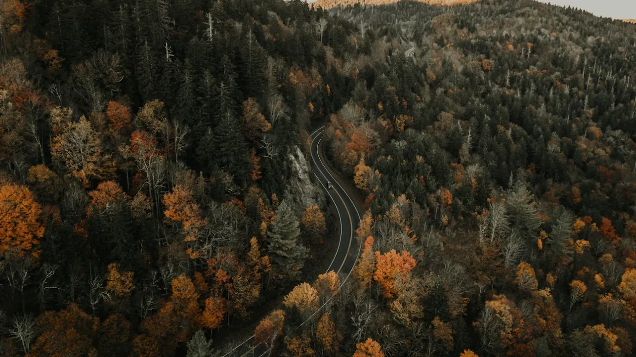
2. Blue Ridge Parkway, VA/NC: The Appalachian Forest Epic
"469 miles of pure 'flow' without a single stoplight."
-
Overview: Winding through the heart of the Appalachian Highlands, the Blue Ridge Parkway is a protected sanctuary for cyclists. It is a masterpiece of landscape engineering, designed specifically for scenic enjoyment. With commercial traffic banned and no stoplights for its entire length, it offers an uninterrupted "Zen" experience through some of the oldest forests on the continent. [Blue Ridge Parkway Digital Map] [Blue Ridge Parkway Digital & Print Parkway Brochures]
-
The Vibe: A high-altitude sanctuary where you ride through clouds and ancient mountain crests.
-
Total Distance: 469 miles (755 km).
-
Physical Address: Linn Cove Viaduct, Blue Ridge Pkwy, Linville, NC 28646.
-
Recommended Bike: Endurance Road Bike / Light Gravel Bike.
-
Highlight Segment: The High Peaks (Milepost 350 to 469) — A dramatic stretch from the shadow of Mount Mitchell into the Great Smoky Mountains.
-
Pro Tip: Temperature swings can be 30°F between the peaks and valleys. Carry a packable graphene windshell to stay warm during long descents.
-
Best For: Climbing purists, "Zen" seekers, and forest bathers who want zero traffic interruptions.
| Category | Details | Editor’s Notes |
|---|---|---|
| Difficulty Level | ★★★★★ | Massive cumulative elevation gain throughout the route. While the gradients are rarely extreme, the climbs are long and relentless, making pacing and endurance crucial. |
| Best Season | Mid to Late October | Peak fall foliage season in the Blue Ridge Mountains. Expect larger crowds, but this is also when the region is at its most spectacular. |
| Road Surface | 100% Paved | The pavement offers excellent drainage quality. However, fallen leaves during autumn can create slippery conditions, especially on descents and corners. |
| 2026 Status | Improved Safety | In 2026, all 26 tunnels along the route completed smart lighting upgrades, significantly improving visibility and cycling safety. |
3. Empire State Trail, NY: From Manhattan Skyline to Erie Canal
"The cultural heartbeat of the East Coast."
-
Overview: 2026 marks the Empire State Trail's evolution into a global model for multi-use greenways. Connecting the bustling energy of Manhattan to the serene Canadian border, it utilizes former rail corridors to provide a flat, car-free path through New York’s revolutionary history and burgeoning wine country.
-
The Vibe: A sophisticated blend of urban skyline views and pastoral river-valley tranquility.
-
Total Distance: 750 miles (1,207 km).
-
Physical Address: Walkway Over the Hudson, 87 Haviland Rd, Poughkeepsie, NY 12601.
-
The Three Legendary Segments:
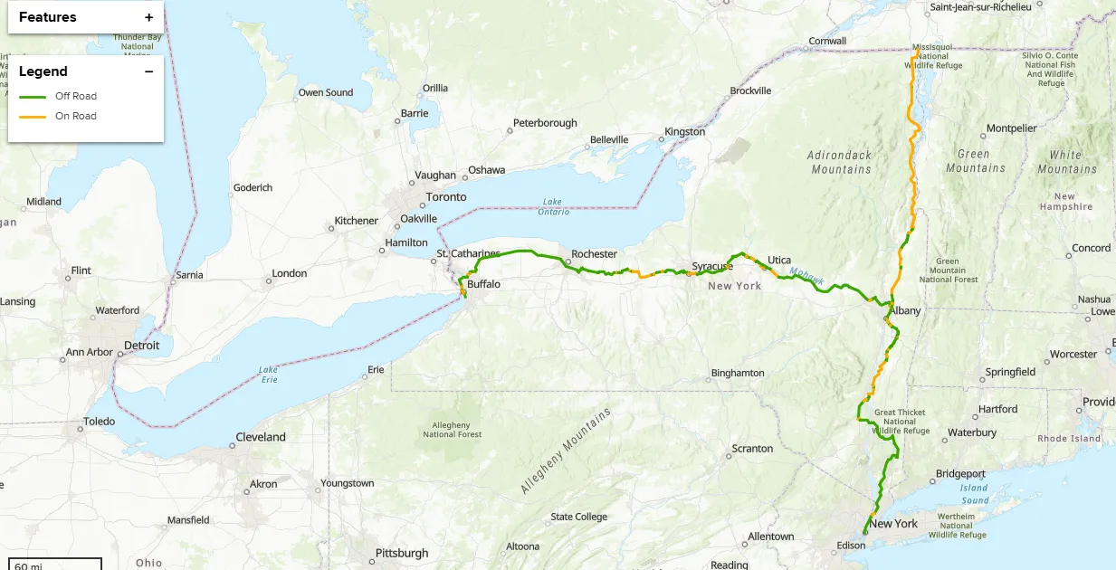 Image from empiretrail.ny.gov, Copyright by original author
-
Hudson Valley Greenway Trail:
-
Endpoints: Battery Park (NYC) to Albany.
-
The Draw: A mix of paved trails and quiet roads passing through historic estates (like the Vanderbilt Mansion) and the breathtaking Walkway Over the Hudson.
-
-
Erie Canalway Trail:
-
Endpoints: Albany to Buffalo.
-
The Draw: 360 miles of nearly flat riding along the historic 19th-century canal. Perfect for "slow cycling" through charming lift-bridge towns and industrial heritage sites.
-
-
Champlain Valley Trail:
-
Endpoints: Albany to Rouses Point (Canadian Border).
-
The Draw: A scenic journey through the Adirondack foothills and along the shores of Lake Champlain, offering some of the best agricultural vistas in the state.
-
-
-
Recommended Bike: Hybrid Bike / Gravel Bike (35c+ tires).
-
Highlight Segment: Hudson Valley Greenway (NYC to Albany) — Historic estates and river vistas.
-
Pro Tip: Take a "Hub-and-Spoke" approach. Base yourself in towns like Rhinebeck and explore the local craft breweries and independent bookstores.
-
Best For: Cultural travelers, families, and entry-level tourers who love craft beer and history.
| Category | Details | Editor’s Notes |
|---|---|---|
| Difficulty Level | ★★☆☆☆ | Extremely gentle, ideal for maintaining a steady pace and very knee-friendly. |
| Best Season | May – June | Late spring to early summer; the river valley is cool and dry, and local town markets are at their most lively. |
| Road Surface | Mixed surface | Alternating asphalt and fine gravel; 35c or wider tires are recommended for a balance of comfort and stability. |
| 2026 Status | Extremely convenient | All train stations along the route now support “bike-friendly boarding,” allowing riders to end their trip and return to the city at any time. |
4. Route 66: The "Centennial Mother Road"
"Pedaling through the neon-lit history of America."
-
Overview: As America turns 250, the "Mother Road" turns 100. This route is a nostalgic pilgrimage through the golden age of Americana. While much of the old highway is replaced by interstates, the preserved cycling segments are a living museum of vintage gas stations, neon motels, and kitschy roadside attractions.
-
The Vibe: A time-traveling adventure across the Mojave Desert and the Great Plains.
-
Total Distance: ~2,400 miles (3,862 km) total; ~300 miles of prime cycling segments.
-
Physical Address: Midpoint Café, 305 West 2nd St, Adrian, TX 79001.
-
Recommended Bike: Gravel Bike / Adventure Touring Bike (robust 38c tires).
-
Highlight Segment: Seligman to Kingman, AZ — The longest continuous stretch of original "Mother Road" pavement.
-
Pro Tip: Use a bike with high-volume tires; the historic pavement can be abrasive and cracked in some desert sections.
-
Best For: Nostalgia buffs, Pop-Culture fans, and those who want to ride into the heart of the "American Dream."
|
Category |
Details |
Editor's Notes |
|---|---|---|
|
Difficulty Level |
★★☆☆☆ |
Relatively flat rolling hills; heat and exposure are the primary challenges. |
|
Best Season |
April - May |
Mild desert temperatures before the summer heat hits triple digits. |
|
Road Surface |
100% Paved |
Historic pavement can be abrasive; high-volume tires provide necessary vibration damping. |
|
2026 Status |
AR Heritage |
New AR-enabled "Time Travel" points showing the road as it looked in 1926. |
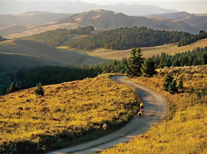
5. The Great Divide Mountain Bike Route (GDMBR)
"The ultimate off-road test of grit."
-
Overview: This is the world's premier off-road bikepacking route, tracing the spine of the continent along the Continental Divide. From the Canadian border to the Chihuahuan Desert, it offers an unfiltered encounter with the American wilderness, featuring high-altitude passes and massive wildlife.
-
The Vibe: Gritty, remote, and spiritually transformative; the "Everest" of bikepacking.
-
Total Distance: 2,700 miles (4,345 km).
-
Physical Address: Brush Mountain Lodge, 31100 Co Rd 129, Slater, CO 81653.
-
Recommended Bike: Hardtail Mountain Bike / Drop-bar Bikepacking Rig.
-
Highlight Segment: The Colorado High Country (Steamboat Springs to Del Norte) — Majestic 12,000-foot passes and alpine meadows.
-
Pro Tip: Ensure your smartphone's satellite SOS features are active. In 2026, satellite connectivity is the primary safety net for the Gila Wilderness.
-
Best For: Hardcore bikepackers, wilderness survivalists, and those seeking total isolation and raw adventure.
|
Category |
Details |
Editor's Notes |
|---|---|---|
|
Difficulty Level |
★★★★★ |
Extreme. High altitude, extreme weather, and mechanical self-sufficiency required. |
|
Best Season |
July - August |
Only window where high-altitude passes are snow-free and wildflower-rich. |
|
Road Surface |
100% Unpaved |
Dirt roads and singletrack; tubeless tires with double sealant are mandatory. |
|
2026 Status |
Starlink Mesh |
Shared satellite safety beacons now standard for solo crossers in the Gila. |
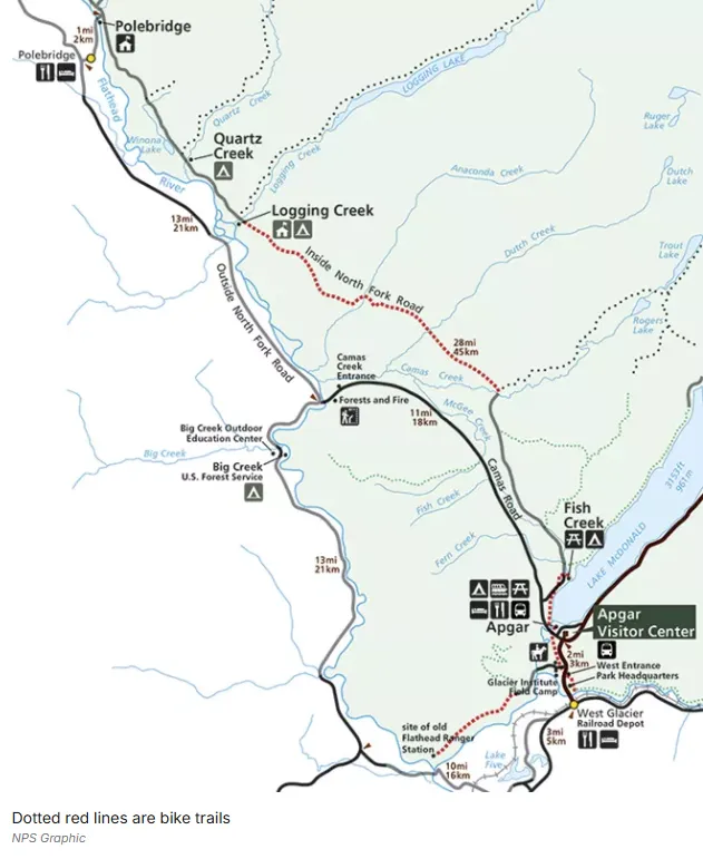
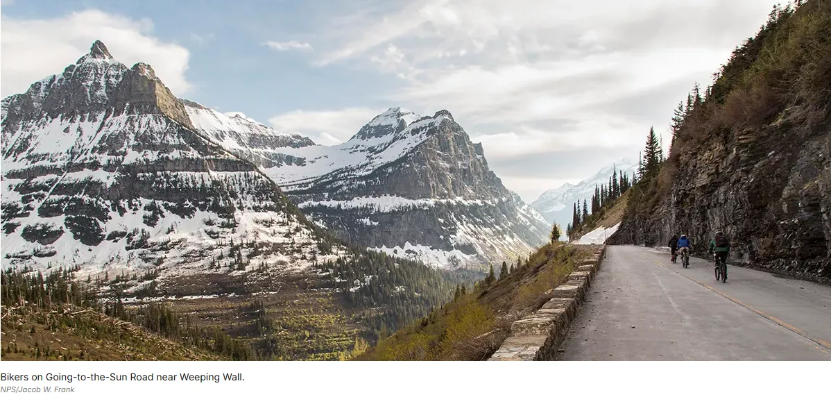
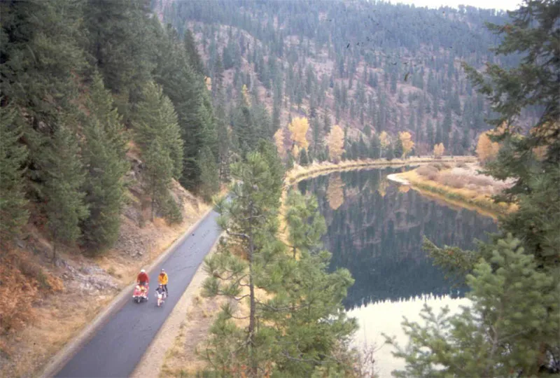
6. Going-to-the-Sun Road, Montana (Glacier NP)
"Touching the sky in the crown of the continent."
-
Overview: Located within the majestic Glacier National Park, this road is a triumph of engineering and a feast for the eyes. In 2026, the road management has extended "Cyclist-Only" windows in late spring, allowing riders to climb through massive snow walls to the Continental Divide without the presence of tour buses.
-
The Vibe: A breathtaking, high-stakes alpine climb that feels like riding on the roof of the world.
-
Total Distance: 50 miles (80 km) point-to-point.
-
Physical Address: Logan Pass Visitor Center, West Glacier, MT 59936.
-
Recommended Bike: Lightweight Road Bike / E-Road Bike.
-
Highlight Segment: The Garden Wall (The Loop to Logan Pass) — 10 miles of sheer vertical beauty carved into the mountain.
-
Pro Tip: Cyclists have "Dawn Access" (before 10 AM) before the road opens to car traffic. It is the only time to experience the park in near-total silence.
-
Best For: High-altitude photographers, elite climbers, and those who want the most dramatic scenery-per-mile.
|
Category |
Details |
Editor's Notes |
|---|---|---|
|
Difficulty Level |
★★★★☆ |
Sustained alpine climbing; requires good descending skills for the return trip. |
|
Best Season |
Late May - June |
The "Cyclist Window" before cars are allowed; snow walls can be 20ft high. |
|
Road Surface |
100% Paved |
Narrow with tight hairpins; check brake pads before starting the descent. |
|
2026 Status |
Permit Only |
2026 introduces a digital "Cycling Permit" to protect Logan Pass's fragile ecology. |
7. Florida Keys Overseas Heritage Trail
"Cycling on water across 42 bridges."
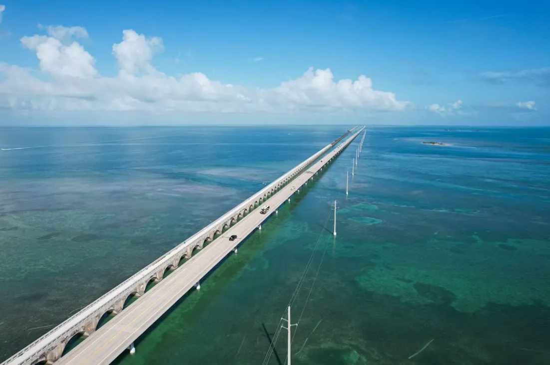
-
Overview: A tropical island-hopping journey that utilizes the historic Flagler Railroad corridor. The trail connects the Florida mainland to the southernmost point of the continental U.S., offering cyclists a unique vantage point of coral reefs, turquoise lagoons, and the vast Atlantic Ocean.
-
The Vibe: Laid-back, humid, and visually surreal; an island paradise on two wheels.
-
Total Distance: 106 miles (170 km).
-
Physical Address: Seven Mile Bridge, Overseas Hwy, Marathon, FL 33050.
-
Recommended Bike: Touring Bike / Beach Cruiser / Flat-bar Road Bike.
-
Highlight Segment: The Seven Mile Bridge — An unparalleled sense of floating over the ocean on the dedicated bike span.
-
Pro Tip: Pack high-UPF clothing and electrolyte tabs; the 2026 Caribbean sun is unforgiving, even during the "cooler" winter months.
-
Best For: Winter escapists, casual riders, and sunset lovers who enjoy a tropical party at the finish line.
|
Category |
Details |
Editor's Notes |
|---|---|---|
|
Difficulty Level |
★☆☆☆☆ |
The flattest route in the guide; the only climb is the crest of the bridges. |
|
Best Season |
Dec - March |
The perfect winter getaway; avoids the humidity and storms of hurricane season. |
|
Road Surface |
100% Paved |
Dedicated cycle path for 90% of the route; very safe for mixed-ability groups. |
|
2026 Status |
Eco-Link |
2026 sees the full electrification of Key West shuttles for easy return trips. |
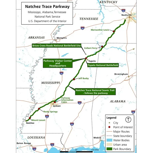
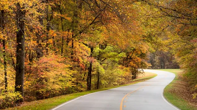
8. The Natchez Trace Parkway, MS/AL/TN
"A rolling journey through 10,000 years of history."
-
Overview: This National Park Service road follows an ancient path used by Native Americans and early settlers. It is a slow-speed, commercial-free corridor that winds through dense Southern forests, cypress swamps, and historic mounds, providing a deep dive into the soul of the American South.
-
The Vibe: Serene, rolling, and deeply historical; a meditative journey through green tunnels.
-
Total Distance: 444 miles (715 km).
-
Physical Address: Natchez Trace Parkway Visitor Center, 2680 Natchez Trace Pkwy, Tupelo, MS 38804.
-
Recommended Bike: Class 1 E-Bike / Touring Road Bike.
-
Highlight Segment: The Tennessee Ridges (Milepost 400 to 444) — Dense forests and deep valleys near Nashville.
-
Pro Tip: Utilize the "Bike-Only" campsites; these hidden spots are reserved specifically for cyclists and are free of RV noise.
-
Best For: Solo meditators, history buffs, and E-bikers who appreciate a gentle, rolling rhythm.
|
Category |
Details |
Editor's Notes |
|---|---|---|
|
Difficulty Level |
★★☆☆☆ |
Gentle rolling grades; no extreme peaks, but constant up-and-down rhythm. |
|
Best Season |
April or October |
Spring wildflowers or deep autumn color; avoids the swampy summer heat. |
|
Road Surface |
100% Paved |
Ultra-smooth parkway asphalt with a strict 50mph car speed limit. |
|
2026 Status |
Quiet Zones |
Designated "Silent Miles" where all electronic devices are encouraged to be off. |
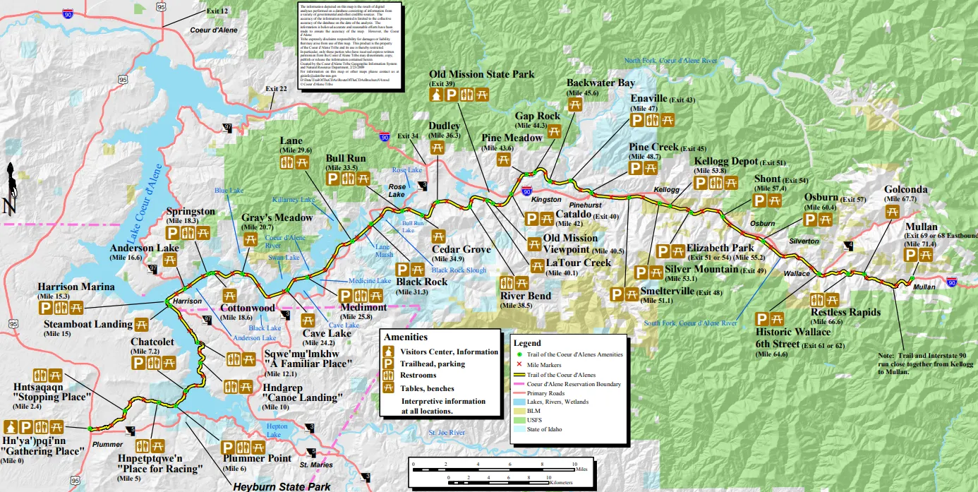
9. Trail of the Coeur d'Alenes, Idaho
"The silver valley’s paved masterpiece."
-
Overview: Consistently ranked as one of the top rail-trails in the U.S., this perfectly paved path runs through the heart of the Idaho Panhandle. It follows the path of the old Union Pacific railroad, crossing over pristine lakes, marshes teeming with wildlife, and through historic mining towns.
-
The Vibe: Peaceful, accessible, and naturally stunning; ideal for long-distance cruising without the stress of hills.
-
Total Distance: 73 miles (117 km).
-
Physical Address: Chatcolet Bridge, Heyburn State Park, Plummer, ID 83851.
-
Recommended Bike: Road Bike / Hybrid / Recumbent.
-
Highlight Segment: Lake Coeur d'Alene Crossing — Riding on the expansive bridge over the pristine, crystal-blue water.
-
Pro Tip: Keep an eye out for bald eagles and ospreys. The lake segments are prime habitat for these majestic birds.
-
Best For: Families, bird-watchers, and endurance riders who want a "perfect pavement" experience.
|
Category |
Details |
Editor's Notes |
|---|---|---|
|
Difficulty Level |
★☆☆☆☆ |
Exceptionally flat; designed for accessible cruising for all fitness levels. |
|
Best Season |
August |
Warm lake temperatures for post-ride swims; ideal for family camping. |
|
Road Surface |
100% Paved |
Famous for its "carpet-smooth" asphalt; great for narrow road tires. |
|
2026 Status |
Osprey Cam |
Interactive QR stops along the marsh segments show real-time nesting footage. |
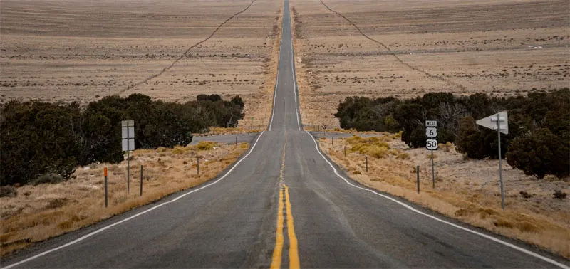
10. The Loneliest Road (Hwy 50), Nevada
"Solitude for the soul across the Great Basin."
-
Overview: Dubbed "The Loneliest Road in America" by Life Magazine, this route is a stark, beautiful test of endurance. It traverses the "Basin and Range" topography of Nevada, climbing over 7,000-foot passes only to descend into vast, silent desert basins where the horizon feels infinite.
-
The Vibe: Introspective, vast, and challenging; a pure encounter with silence and starlight.
-
Total Distance: ~400 miles (644 km) within Nevada.
-
Physical Address: Great Basin National Park Entrance, Baker, NV 89311.
-
Recommended Bike: Long-distance Touring Bike / Gravel Bike.
-
Highlight Segment: Austin to Eureka — Crossing multiple mountain passes with views that stretch for 50 miles in every direction.
-
Pro Tip: Use the 2026 "Smart Cache" app to locate verified solar-powered water generators. Some desert stretches are now equipped with atmospheric water tech.
-
Best For: Endurance athletes, deep thinkers, and those who find beauty in extreme minimalism and desert horizons.
|
Category |
Details |
Editor's Notes |
|---|---|---|
|
Difficulty Level |
★★★★☆ |
Psychologically taxing; involves long gaps between water and food stops. |
|
Best Season |
May or October |
Avoids the furnace-like summer heat and the brutal winter snow of the high passes. |
|
Road Surface |
100% Paved |
Very straight, but crosswinds can be powerful in the desert basins. |
|
2026 Status |
Dark Sky |
2026 designation of "Cycling Dark Sky Corridor" with solar-lit path markers. |
III. Urban Paradises: The 2026 Bike-Friendly City Power Rankings
In 2026, the American urban landscape has shifted. The "15-Minute City" initiative, accelerated by the 250th Anniversary infrastructure grants, has turned several metropolises into world-class cycling hubs. These three cities represent the pinnacle of North American bike-friendly design.
1. Portland, Oregon: The "Platinum" Standard
-
The Status: Long the "cycling capital" of the US, Portland in 2026 features a fully integrated "Green Loop" circling the city center.
-
Best Experience: Crossing the Tilikum Crossing at sunrise—the only major bridge in the US dedicated to light rail, buses, and cyclists, with zero private cars.
-
2026 Special: The "Bike-to-Beer" 250th Edition, where 25 local breweries offer digital stamps for cyclists, leading to a commemorative 2026 growler.
2. Minneapolis, Minnesota: The Greenway Leader
-
The Status: Boasting more miles of off-street bike paths than almost any other US city, Minneapolis is the king of the "Midwest Flow."
-
Best Experience: Riding the Midtown Greenway, a 5.5-mile former railroad corridor that acts as a cycling "superhighway" through the heart of the city.
-
2026 Special: The "Chain of Lakes" Night Ride, featuring bioluminescent path markers installed for the anniversary summer.
3. Washington D.C.: The Anniversary Epicenter
-
The Status: As the heart of the 250th celebrations, D.C. has expanded its protected bike lane network to connect all major monuments.
-
Best Experience: The Mount Vernon Trail at dusk, offering a panoramic view of the illuminated National Mall across the Potomac.
-
2026 Special: "The Capital Loop" — a 25-mile car-free parade route passing every major Smithsonian museum, open every Sunday morning in July 2026.
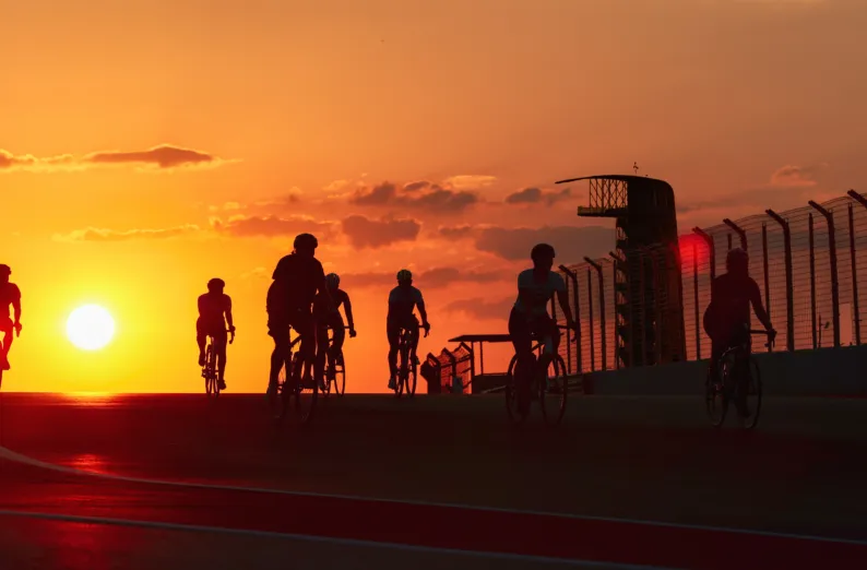
IV. The Speed Trap: Cycling the F1 Circuits
For the high-performance cyclist, 2026 offers a rare opportunity: a new subculture of "Asphalt Pilgrims" has emerged, seeking the ability to ride on the same asphalt as the world's elite Formula 1 drivers.
1. Circuit of the Americas (COTA) — Austin, Texas
-
The Event: "Bike Night at COTA."
-
The Thrill: Climbing the iconic Turn 1, a steep 133-foot elevation gain that tests your legs against the same incline that challenges F1 engines.
-
2026 Status: To celebrate the "Centennial of Speed," COTA has introduced "Gravel-to-Grid" weekends, where riders can transition from the park's perimeter gravel trails directly onto the GP track.
-
Booking & Entry Info (2026 Update):
-
Tickets: Available exclusively via the COTA Official App or COTA website.
-
Pricing: $25 per session (includes a timing transponder). Season passes for the Spring/Fall series are $150.
-
Schedule: Typically every Tuesday night (March–June & September–November). Check-in starts at 5:30 PM; track access from 6:00 PM to sunset.
-
Requirements: Helmets are mandatory. All bike types (including Class 1 E-bikes) are welcome, but aero-bars must be in a "hands-on-brakes" position during group starts.
-
2. Miami International Autodrome — Miami, Florida
-
The Event: "The Sunrise Lap Series."
-
The Thrill: Weaving through the complex turns surrounding the Hard Rock Stadium. It’s flat, fast, and surreal, usually accompanied by the humid Atlantic breeze.
-
2026 Status: Limited-edition night rides under the F1 stadium lights, using silent electric safety cars to lead peloton groups.
3. Las Vegas Strip Circuit (Hard Rock Stadium) — Las Vegas, Nevada
-
The Event: "The Neon Midnight Ride."
-
The Thrill: 2026 marks the first time the city closes the iconic F1 Strip Circuit to all traffic for a 3-hour "Cyclists' Takeover" on July 4th.
-
The Vibe: Riding through the heart of the Las Vegas Strip under the glow of the Sphere and the neon marquees without a single taxi in sight.
|
Category |
Details |
Editor's Notes |
|---|---|---|
|
Intensity |
★★★☆☆ (Intervals) |
These sessions are short but high-intensity; great for testing your top speed. |
|
Best Season |
Year-round (specific dates) |
Check the race calendars; track days usually happen 2-3 months before the GP. |
|
Surface |
Racing Grade Asphalt |
The smoothest pavement you will ever ride. High-PSI tires recommended. |
|
2026 Perk |
"Ghost Pacing" |
2026 tracks offer AR headsets that project a "ghost" of a pro cyclist for you to chase. |
V. The Pro’s "No-Regret" Checklist
1. Survival & Safety Etiquette
-
The "STOP" Rule: A "Full Foot-Down Stop" at stop signs is the only way to avoid the $150 "Cyclist Fine" being strictly enforced in 2026 tourist zones. Don't track-stand your way into a ticket.
-
Radar is Standard: Devices like the Garmin Varia are now considered a "social contract" for group rides in North America. If you're at the back, your radar is the eyes of the peloton.
-
Taking the Lane: Don't hug the gutter. On narrow roads or high-traffic corridors, claim the center of the lane (Defensive Riding) to discourage unsafe, "squeeze-by" passes from motorists.
2. Logistics & Resupply
-
BikeFlights: Still the gold standard for shipping your "steed" safely. Avoid the airline baggage fee headache and have your bike waiting for you at a local shop at your destination.
-
Gas Station Oases: The American gas station is a cyclist's best friend. Use the "Water/Ice" tab on soda fountains—it is culturally accepted and usually free.
-
The Pumping Rule: Respect the "No Repairing in Pump Lanes" rule. Move your bike to the side or a designated rest area to avoid conflict with drivers.
-
Digital Sovereignty: Keep your 2026 "USBRS Digital Pass" downloaded offline. High-altitude and desert routes often have dead zones where cloud-based maps will fail you.
VI. FAQ: 2026 American Cycling - What You Need to Know
Q1: Is it safe to cycle across the USA in 2026? What about bike theft?
A: Safety varies by environment. In major hubs like San Francisco or New York, "Eyes on Bike" is the golden rule. Always use a high-security U-lock; cable locks are easily bypassed. For long-distance tours, the main "threats" are wildlife (bears in the West) rather than people. We recommend securing Comprehensive Travel Insurance for Long-Distance Cycling that covers both medical emergencies and equipment theft.
Q2: What happens if my bike breaks down in a remote "Dead Zone"?
A: By 2026, most major routes are part of the USBRS (U.S. Bicycle Route System) network, which features "Bike-Friendly Hubs" in trail towns. If you are in a no-service area, your satellite-enabled smartphone is your lifeline. Additionally, roadside assistance providers like AAA now offer specialized Bicycle Roadside Recovery for members on most paved corridors.
Q3: How do I handle logistics like water and electricity for my E-bike?
A: Most gas stations and public parks offer free water. For E-bikes, look for the "Green-Watt" certification logo at cafes and campgrounds, which indicates fast-charging stations for Class 1 and Class 2 E-bikes. Many Bicycle-Friendly Hotels now offer secure, indoor charging rooms as a standard amenity for 2026 travelers.
Q4: Can I take my bike on Amtrak or regional buses?
A: Amtrak: Most 2026 "Anniversary Era" trains have dedicated bike cars, but you must reserve a "Bike Add-on" ticket in advance. Intercity Buses (Greyhound/FlixBus): You generally need a Bike Travel Box (cardboard or hardshell), and it will be treated as oversized checked luggage.
Q5: Is tipping expected at bike repair shops in the States?
A: While not mandatory, it is a common "Cyclist Social Contract." If a mechanic performs a quick "emergency fix" (like truing a wheel or adjusting a derailleur) for free or a nominal fee, a $5–$10 tip or buying them a cold drink is a great way to show appreciation. For major overhauls, the service fee is sufficient.
Q6: What is the "The Wave" I keep seeing on rural roads?
A: This is the American Roadside Salute. If a driver gives you extra space or waits for you to pass, a simple hand wave or a nod of the head is expected. It builds mutual respect between motorists and the cycling community.
Final Conclusion: Ride the Legend
2026 is more than a year; it is a celebration of movement. Whether you are seeking the silence of the Nevada desert or the speed of an F1 circuit, the American road is waiting. Pack your bags, check your tire pressure, and prepare to write your own chapter in the republic's history.