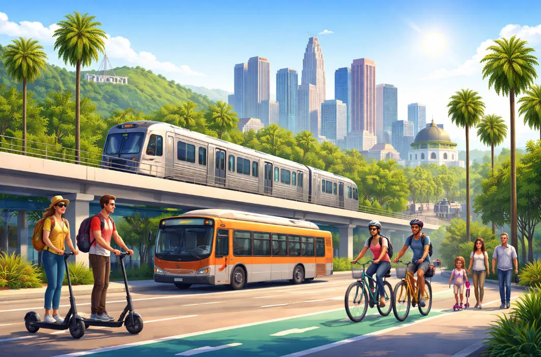
Los Angeles, the sprawling City of Angels, has long been synonymous with car culture and endless freeways. But in 2026, with the FIFA World Cup bringing global attention and preparations for the 2028 Olympics accelerating transit improvements, going car-free is not just feasible—it's smart, sustainable, and surprisingly efficient. This ultimate guide equips you with everything you need to navigate LA without a vehicle, focusing on the Metro rail and bus systems, shared bikes and scooters, and ridesharing options. Whether you're a tourist dodging rental fees or a local reducing your carbon footprint, you'll save time, money, and stress while exploring iconic spots from Downtown to Santa Monica. Let's dive in.
Why Go Car-Free in 2026?
Going car-free in Los Angeles might sound surprising—but in 2026, it’s smarter, easier, and more practical than ever. Here’s why many travelers and residents are ditching the rental car.
1. LA Traffic Is Still One of the Worst in the U.S.
Los Angeles consistently ranks among the most congested cities in America. Peak-hour traffic can easily double or triple travel time, especially on I-405, I-10, and US-101.
Car-free advantage: Metro trains and dedicated bus lanes let you bypass gridlock entirely.
2. Driving Costs Keep Rising
In 2026, the true cost of driving in LA includes:
-
Expensive parking ($20–$50/day in popular areas)
-
High gas prices
-
Rental car fees, insurance, and deposits
-
Parking tickets and street-cleaning fines
Car-free advantage: Public transit, bikes, and occasional ride-hailing are often far cheaper.
3. Los Angeles Metro Is Bigger & Better Than Ever
LA has invested heavily in transit ahead of major global events:
-
Expanded Metro rail lines connecting Downtown, Santa Monica, Hollywood, Pasadena, and LAX
-
Faster, cleaner trains and buses
-
Improved safety, signage, and mobile apps
Car-free advantage: You can now reach many major attractions without driving.
4. Bikes & Scooters Are Everywhere
Shared mobility has become mainstream:
-
Protected bike lanes in central LA and beach cities
-
Easy-to-use bike and e-scooter apps
-
Perfect for short trips, sightseeing, and last-mile connections
Car-free advantage: Short rides are often faster than driving—and more fun.
5. More Sustainable & Stress-Free Travel
Going car-free helps:
-
Reduce carbon emissions
-
Avoid parking stress
-
Eliminate the fear of accidents or tickets in an unfamiliar city
Car-free advantage: You experience LA like a local, not a frustrated driver.
Essential Tools: TAP Card and Apps
To travel car-free in Los Angeles smoothly, you only need one transit card and a few must-have apps. In 2026, LA’s public transportation system is largely cashless, mobile-friendly, and easy for visitors to use.
🎫 TAP Card: Your All-in-One Transit Pass
The TAP Card is the official contactless transit card for Los Angeles County.
What You Can Use It For
One TAP card works across multiple systems:
-
LA Metro Rail & Metro Bus
-
Big Blue Bus (Santa Monica)
-
Culver CityBus
-
Long Beach Transit
-
Foothill Transit (select routes)
Perfect for travelers who move between different parts of LA.
How to Get a TAP Card (2026)
You have three easy options:
-
Physical TAP Card
-
Buy at Metro stations (ticket machines)
-
Available at some convenience stores
-
Cost: small one-time card fee + fare
-
-
TAP App (Mobile TAP)
-
iOS & Android
-
Use your phone as the card (Apple Wallet / Google Wallet)
-
No physical card needed
-
-
Airport Purchase
-
Available at LAX Metro & transit-connected stations
-
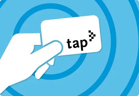
Fares & Daily Caps (Why TAP Saves Money)
-
Flat fares for Metro rail & buses
-
Free transfers within a set time window
-
Daily and weekly fare caps mean you never overpay
-
No need to calculate individual trip costs
📱 Must-Have Apps for Car-Free Travel
🚇 1. LA Metro App (Official)
Best for: Routes, service alerts, real-time arrivals
Features:
-
Live train and bus times
-
Service disruption alerts
-
TAP balance management
-
Station maps and accessibility info
🗺️ 2. Google Maps
Best for: Door-to-door navigation
Why it’s essential:
-
Combines Metro, buses, walking, bikes, and ride-hailing
-
Accurate ETAs
-
Step-by-step directions
-
Platform and stop numbers included
🚲 3. Bike & Scooter Apps
Depending on the area, download:
-
Metro Bike Share
-
Lime
-
Bird
-
Spin
Use them for:
-
Short trips
-
Beach paths
-
First- and last-mile connections
🚕 4. Ride-Hailing Apps (Backup Option)
Even car-free travelers need a Plan B:
-
Uber
-
Lyft
Great for:
-
Late nights
-
Areas with limited transit
💳 5. Payment & Utility Apps
Helpful extras:
-
Apple Wallet / Google Wallet (Mobile TAP)
-
Transit or fare notification settings
-
Offline Google Maps (for areas with weak signal)
-
Group travel
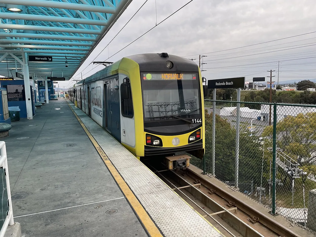
Los Angeles Metro Rail (Subway & Light Rail)
The Los Angeles Metro Rail system is the backbone of car-free travel in LA. In 2026, it’s larger, faster, and far more tourist-friendly than most visitors expect.
Metro Rail at a Glance (2026)
-
6+ color-coded lines covering central and coastal LA
-
Mix of subway (underground) and light rail (above ground)
-
Flat fare with free transfers using TAP
-
Frequent service from early morning to late night
If you stay near a Metro station, going car-free becomes dramatically easier.
Major Metro Rail Lines & What They’re Good For
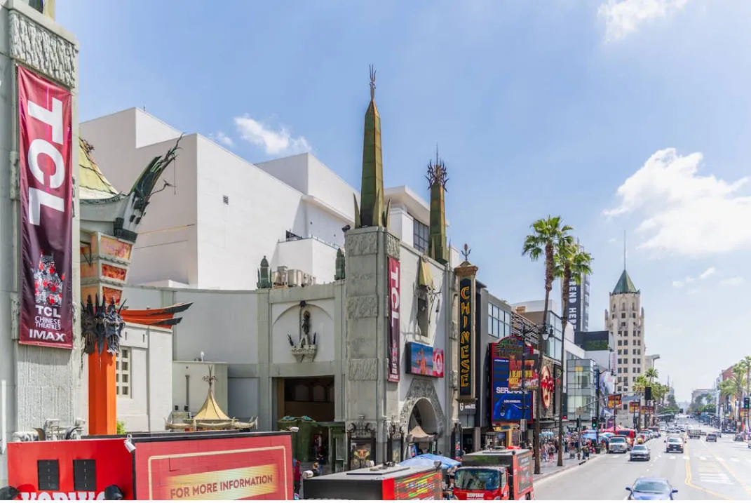
🔴 Red Line (B Line)
Type: Subway
Best for: First-time visitors
Key areas:
-
Downtown LA (Union Station)
-
Hollywood (Walk of Fame, Dolby Theatre)
-
Universal Studios Hollywood
✔️ Fast, frequent, and fully underground
🟣 Purple Line (D Line)
Type: Subway
Best for: Koreatown & West LA access
Key areas:
-
Downtown LA
-
Koreatown
-
Miracle Mile (LACMA area)
✔️ Expanding westward, very useful in 2026
🟡 Expo Line (E Line)
Type: Light rail
Best for: Beaches & museums
Key areas:
-
Downtown LA
-
USC
-
Culver City
-
Santa Monica Beach
✔️ One of the most popular tourist lines
🟢 Gold Line (L Line)
Type: Light rail
Best for: Pasadena & cultural districts
Key areas:
-
Pasadena (Old Town, Rose Bowl area)
-
Chinatown
-
Little Tokyo
✔️ Scenic and less crowded
🟠 Orange Line (G Line)
Type: Bus rapid transit (BRT)
Best for: San Fernando Valley
Key areas:
-
North Hollywood (Red Line connection)
-
Warner Center
✔️ Runs like a train on dedicated lanes
🔵 Blue Line (A Line)
Type: Light rail
Best for: Long trips north–south
Key areas:
-
Long Beach
-
Downtown LA
-
Pasadena (via through-running)
✔️ Longest Metro rail line in the system
Frequency & Operating Hours
-
Peak hours: Every 6–10 minutes
-
Off-peak: Every 10–15 minutes
-
Typical service: ~5:00 AM – Midnight
(Some lines run later on weekends)
How to Ride Metro Rail (Quick Steps)
-
Tap your TAP card or phone at station gates
-
Follow color-coded line signs
-
Board when doors open (let riders exit first)
-
No tap-out required
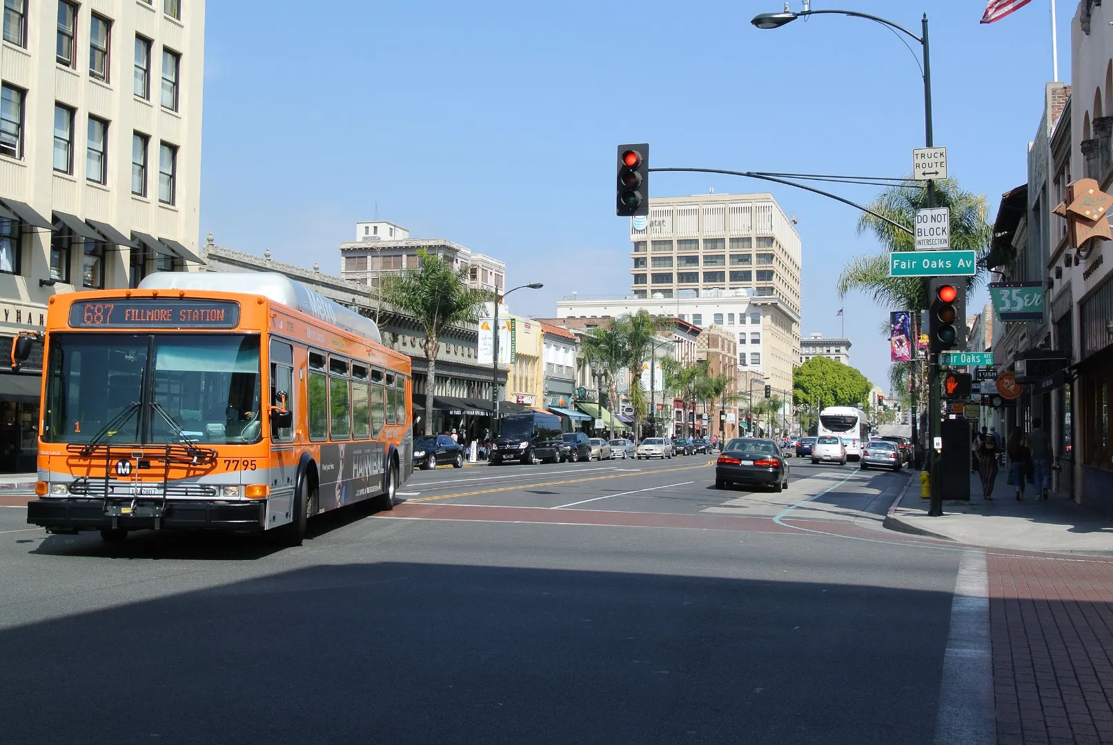
Los Angeles Metro Bus System
If Metro Rail is the backbone of car-free travel in Los Angeles, Metro Buses are the connective tissue. In 2026, the bus network fills in the gaps rail can’t reach—making almost every neighborhood accessible without a car.
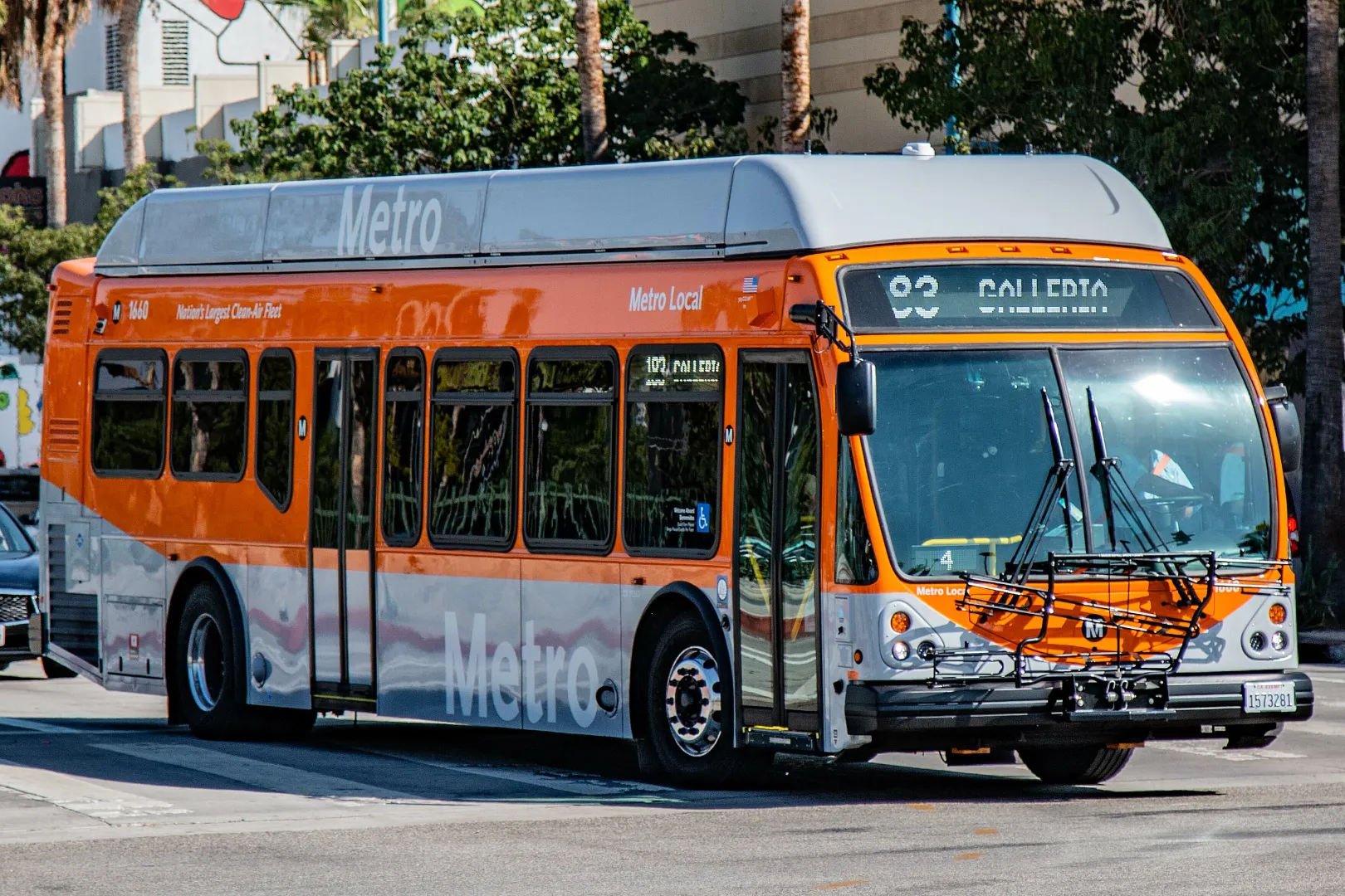
Metro Bus at a Glance (2026)
-
Thousands of routes across LA County
-
Operates 24/7 on major corridors
-
Same TAP card & fare as Metro Rail
-
Frequent service in tourist and residential areas
If a place doesn’t have a train, there’s almost always a bus.
Types of Metro Buses You’ll See
🚏 Local Buses
Best for: Short trips and local neighborhoods
-
Stop every 1–2 blocks
-
Slower, but extremely comprehensive
-
Easy boarding from curbside stops
🚀 Rapid / Express Buses
Best for: Longer distances, faster travel
-
Fewer stops
-
Often run on major boulevards
-
Some use bus-only lanes
✔️ Great alternative when rail isn’t available
🌙 Night & 24-Hour Routes
Best for: Late-night travelers
-
Key routes operate all night
-
Reduced frequency overnight
-
Essential if you’re staying out late downtown or in Hollywood
Most Useful Bus Routes for Car-Free Travelers
-
720 (Wilshire Blvd) – Downtown ↔ Koreatown ↔ Miracle Mile
-
704 (Sunset Blvd) – Downtown ↔ Echo Park ↔ Hollywood
-
2 / 4 (Santa Monica Blvd) – Hollywood ↔ West LA
-
33 (Venice Blvd) – Downtown ↔ Venice Beach
-
Metro Rapid corridors along major streets
These routes connect major attractions and hotels.
Fares, Transfers & Payment
-
Same flat fare as Metro Rail
-
Free transfers within the TAP transfer window
-
No need to pay again when transferring between bus and rail
Tip: Always tap when boarding—cash is increasingly rare.
Frequency & Reliability
-
Peak hours: Every 5–10 minutes on major routes
-
Off-peak: Every 10–20 minutes
-
Real-time tracking via apps makes waiting predictable
How to Ride a Metro Bus (Step-by-Step)
-
Find the stop using Google Maps or LA Metro App
-
Board through the front door
-
Tap your TAP card or phone
-
Take a seat or stand (priority seats near the front)
-
Pull the cord or press the button to request your stop
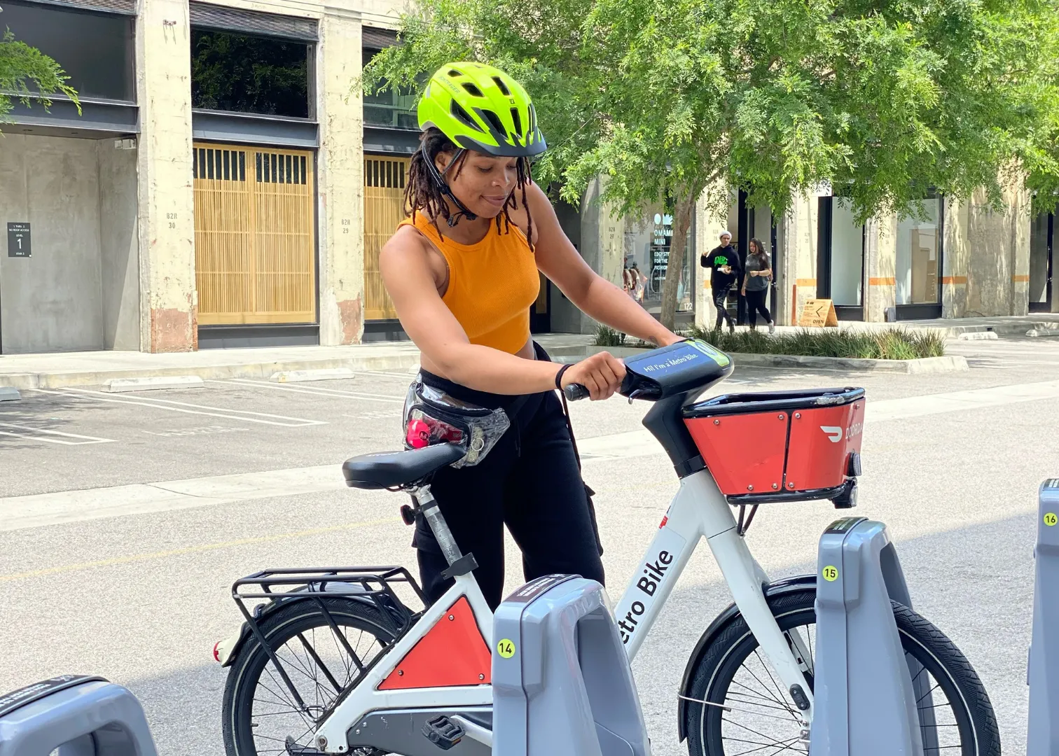
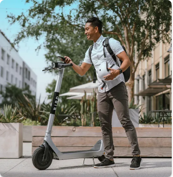
Shared Bikes & Scooters in Los Angeles
For short trips, sightseeing, and “last-mile” connections in Los Angeles, shared bikes and electric scooters are indispensable in 2026. They help you bridge gaps between transit stops and explore neighborhoods at your own pace.
Types of Shared Mobility Options
🚲 Metro Bike Share
-
Publicly operated bike-share system
-
Stations near transit hubs and popular destinations
-
Classic pedal bikes and electric pedal-assist options
🛴 Electric Scooters
-
Dockless shared scooters from companies like Lime, Bird, Spin, etc.
-
Park anywhere legal — no docking station needed
Both are perfect for short distances (1–3 miles), sightseeing, and quick transfers.
Where You’ll Find Them
Shared bikes and scooters cluster around:
-
Metro rail stations
-
Bus stops
-
Beaches (Santa Monica, Venice)
-
Downtown LA
-
Hollywood Boulevard
-
Shopping districts and parks
They’re especially common near places where transit stops but your final destination is a walk away.
How to Use Shared Bikes & Scooters
1. Download the App(s)
Depending on provider:
-
Metro Bike Share app
-
Lime
-
Bird
-
Spin
Many allow in-app navigation and payment.
2. Unlock
-
Scan the QR code on the bike/scooter
-
Tap to unlock
3. Ride
-
Follow local bike/scooter rules
-
Helmets encouraged (required in some areas)
-
Stay in bike lanes where available
4. End Your Trip
-
For dockless scooters/bikes: park responsibly
-
For Metro Bike Share: return to a station dock
Costs & Payment
-
Pay per minute or via short-trip passes
-
Metro Bike Share offers daily/monthly passes
-
Payment via in-app card or mobile wallet
Tip: Compare prices before riding — scooters can be faster but sometimes more expensive.
Best Places to Ride
🌴 Beach Cities
-
Santa Monica bike paths
-
Venice Boardwalk
-
Marvin Braude Bike Trail
Perfect for cruising seaside views.
🚇 Transit Connections
Use bikes/scooters to:
-
Reach your hotel from a rail station
-
Connect between bus stops and light rail
-
Explore neighborhoods beyond transit coverage
Uber & Lyft: The Essential Backup
Even with excellent transit, Uber and Lyft remain an essential part of a car-free strategy in Los Angeles. In 2026, they work best not as your main transportation—but as a smart backup when public transit isn’t ideal.
Why Ride-Hailing Still Matters in LA
Los Angeles is vast and spread out. While Metro, buses, bikes, and scooters cover most needs, there are situations where Uber or Lyft simply makes sense.
Use ride-hailing for:
-
Late-night returns
-
Areas with limited transit
-
Door-to-door convenience
-
Group travel
-
Short, time-critical trips
Think of Uber & Lyft as your Plan B, not Plan A.
Best Times to Use Uber & Lyft
🌙 Late Nights
-
Metro Rail usually stops around midnight
-
Night buses run but with lower frequency
-
Ride-hailing is often the safest and fastest option
🏨 First / Last Mile
Perfect for:
-
Hotel ↔ Metro station
-
Airbnb ↔ bus stop
-
Hills or long walking distances
🧳 Airport Transfers
-
Useful when you have luggage
-
Especially convenient for early morning or late-night flights
-
Popular for LAX when combined with Metro for part of the journey
Cost Expectations (2026 Reality Check)
Uber & Lyft pricing in LA varies widely:
-
Short trips can be affordable
-
Peak hours, events, and bad weather trigger surge pricing
-
Longer distances get expensive quickly
Money-saving tip: Use Metro or buses for long stretches, then Uber for the final 1–3 miles.
How to Get from LAX Without a Car (2026 Guide)
Los Angeles International Airport (LAX) is famously car-centric—but in 2026, getting out of LAX without a car is finally practical. Thanks to new rail connections, frequent buses, and ride-hailing options, you have multiple car-free choices depending on your destination, budget, and luggage.
Option 1: LAX Metro Rail (Best Overall for Car-Free Travelers)
⭐ LAX Automated People Mover (APM)
The LAX People Mover connects all airport terminals to:
-
LAX/Metro Transit Center
-
Metro Rail lines
-
Bus hubs
-
Rental car center
How it works:
-
Exit your terminal and follow signs for LAX Shuttle / People Mover
-
Board the APM (free, frequent, fully automated)
-
Get off at LAX/Metro Transit Center
No traffic. No stress.
🚆 From Transit Center → City
From the LAX/Metro Transit Center, you can connect to:
-
Metro Rail (to Downtown LA and beyond)
-
Metro Buses
-
Regional buses
Use your TAP card or mobile TAP to continue your journey.
✔️ Best for Downtown LA, Hollywood, Koreatown, Pasadena, and transfers to other Metro lines
Option 2: FlyAway Bus (Simple & Luggage-Friendly)
The FlyAway Bus is a nonstop airport bus service.
Key Routes (2026)
-
LAX ↔ Union Station (Downtown LA)
-
Some seasonal or limited routes may operate depending on demand
Why Choose FlyAway?
-
Direct, no transfers
-
Luggage storage underneath
-
Frequent departures
-
Fixed fare
✔️ Best for first-time visitors and travelers with large suitcases
Option 3: Uber & Lyft (Most Convenient)
Ride-hailing is still one of the easiest ways out of LAX—especially:
-
Late at night
-
With heavy luggage
-
When staying far from transit
How It Works at LAX
-
Exit baggage claim
-
Take the LAX-it shuttle or follow app instructions
-
Meet your driver at the designated pickup zone
⚠️ Prices fluctuate due to traffic and demand
✔️ Best as a backup or last-mile option
Option 4: Public Buses (Cheapest, Slowest)
Several Metro and municipal buses serve areas near LAX.
Good for:
-
Budget travelers
-
Nearby neighborhoods
-
Travelers with light luggage
Trade-offs:
-
Slower
-
More walking
-
Less luggage-friendly
✔️ Best if you’re experienced with LA transit
Which Option Should You Choose?
| Destination | Best Choice |
|---|---|
| Downtown LA | FlyAway or Metro Rail |
| Hollywood | Metro Rail + transfer |
| Santa Monica | Metro Rail + bus / bike |
| Late night arrival | Uber / Lyft |
| Heavy luggage | FlyAway or Uber |
| Budget travel | Metro Rail or bus |
Best Car-Free Routes for Tourists
Los Angeles may be sprawling, but many of its most popular tourist areas are surprisingly easy to explore without a car—as long as you choose the right routes. Below are the best-tested, tourist-friendly car-free routes, combining Metro Rail, buses, walking, bikes, and occasional ride-hailing.
1. Downtown LA → Hollywood → Universal Studios
Best for: First-time visitors, iconic sights
How to go (all rail):
-
Metro B Line (Red)
-
Union Station → Hollywood/Highland
-
Continue to Universal City/Studio City
-
Highlights along the way:
-
Walt Disney Concert Hall
-
Hollywood Walk of Fame
-
TCL Chinese Theatre
-
Universal Studios Hollywood
Why it’s great:
✔️ No transfers
✔️ Fully underground
✔️ Very frequent service
2. Downtown LA → Santa Monica Beach
Best for: Beaches, museums, relaxed sightseeing
How to go:
-
Metro E Line (Expo) from Downtown LA → Downtown Santa Monica
Highlights:
-
Santa Monica Pier
-
Third Street Promenade
-
Beach bike paths
-
Easy scooter & bike rentals
Why it’s great:
✔️ One-seat ride
✔️ Scenic and tourist-friendly
✔️ Perfect for car-free beach days
3. Downtown LA → Pasadena (Old Town & Museums)
Best for: Culture, architecture, quieter neighborhoods
How to go:
-
Metro A Line (Blue) northbound → Pasadena
Highlights:
-
Old Pasadena shopping & dining
-
Norton Simon Museum
-
Rose Bowl area (short bus or bike)
Why it’s great:
✔️ Comfortable light rail
✔️ Walkable destination
✔️ Less crowded than beach routes
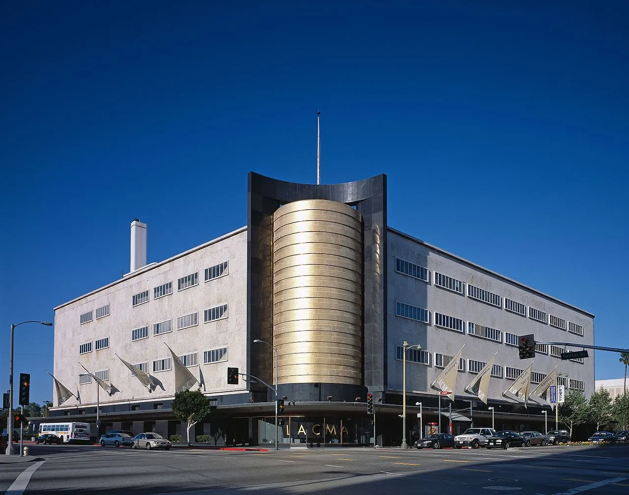
4. Koreatown → Miracle Mile (Museums Row)
Best for: Museums, food lovers
How to go:
-
Metro D Line (Purple) or bus along Wilshire Blvd
Highlights:
-
LACMA
-
Academy Museum of Motion Pictures
-
Petersen Automotive Museum
Why it’s great:
✔️ Short distances
✔️ Excellent food options
✔️ Easy bus + subway combo
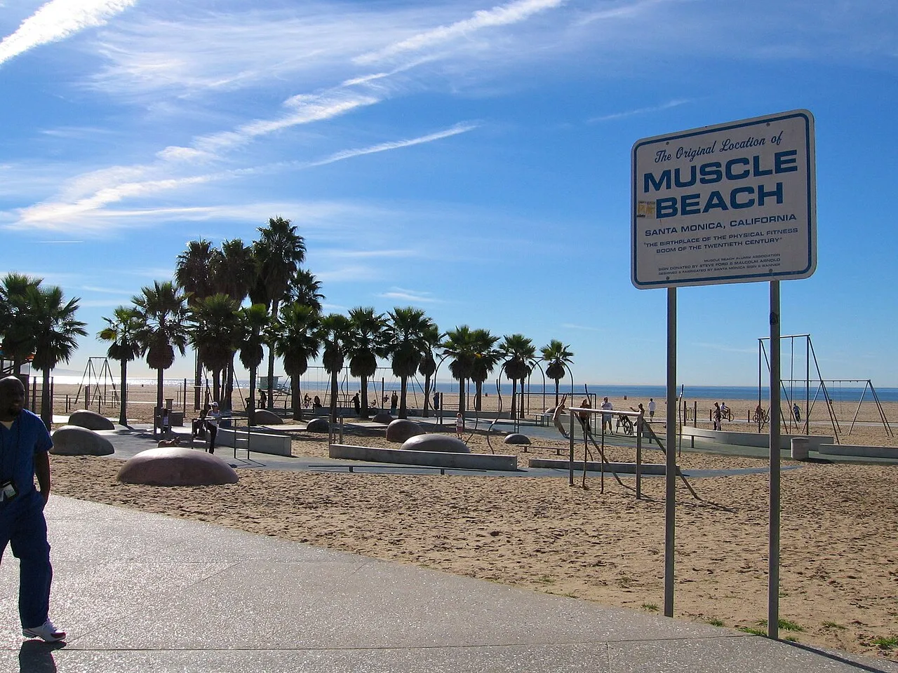
5. Santa Monica → Venice Beach → Marina del Rey
Best for: Outdoor lovers, biking & scooters
How to go:
-
Walk, bike, or scooter along the Marvin Braude Bike Trail
Highlights:
-
Venice Boardwalk
-
Muscle Beach
-
Oceanfront views
Why it’s great:
✔️ No transit needed
✔️ Flat, safe paths
✔️ One of the best car-free experiences in LA
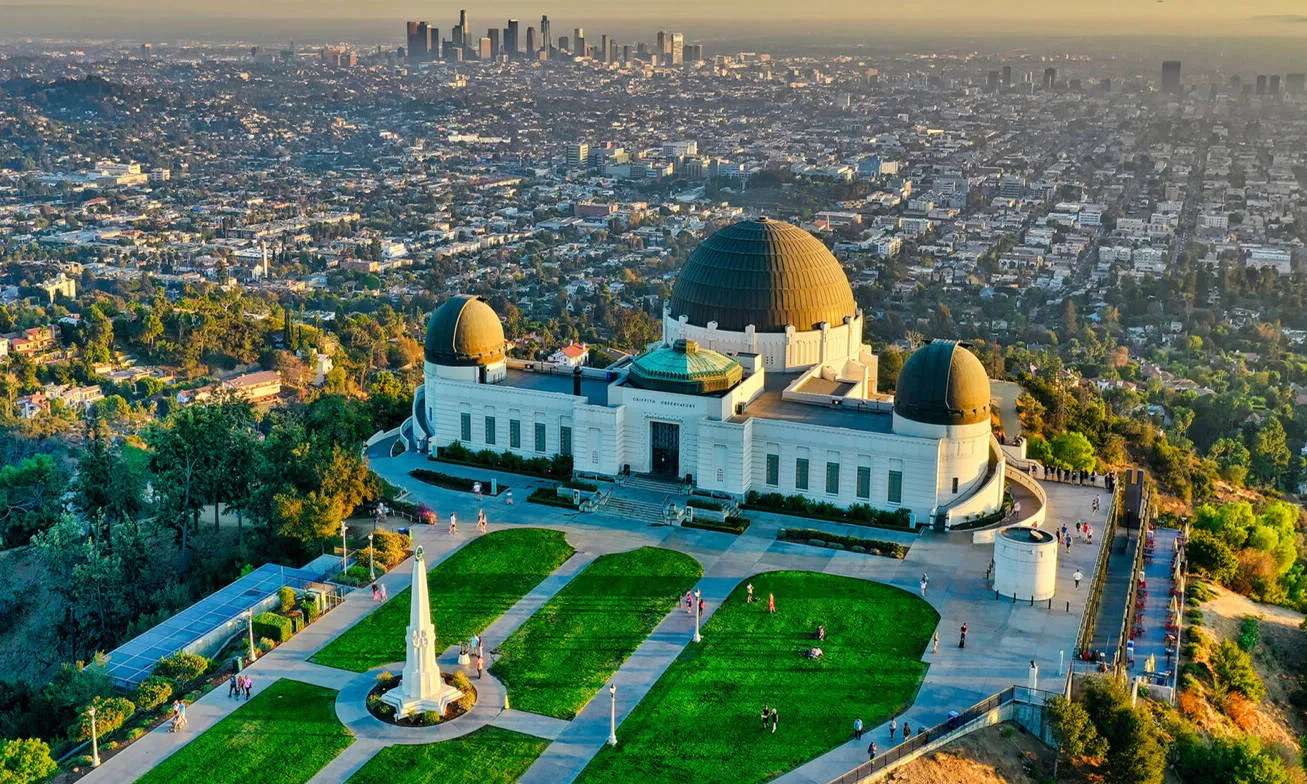
6. Hollywood → Griffith Observatory (Car-Free Version)
Best for: City views, sunsets
How to go:
-
Metro B Line → Hollywood/Western
-
Bus + short uphill walk or rideshare for last mile
Why it’s great:
✔️ Avoid parking chaos
✔️ Sunset views without driving stress
Money-Saving Tips (Very Important)
Going car-free in Los Angeles isn’t just about convenience—it can save you hundreds of dollars if you do it right. These tips are especially important for tourists, international visitors, and first-time LA travelers in 2026.
1. Always Use TAP Fare Capping (Never Overpay)
LA Metro uses daily and weekly fare caps.
What this means:
-
You pay per ride
-
Once you hit the daily cap, the rest of the day is free
-
Same logic applies to weekly caps
✅ Never buy single paper tickets
✅ Just tap with TAP card or Mobile TAP
Pro tip: Even casual riders save money automatically.
2. Use Metro Rail for Long Distances
Long east-west or north-south trips can be:
-
$20–$60 by Uber
-
A flat Metro fare by train
Best value rail routes:
-
Downtown ↔ Santa Monica (E Line)
-
Downtown ↔ Hollywood (B Line)
-
Downtown ↔ Pasadena (A Line)
💰 Biggest savings come from using rail instead of ride-hailing.
3. Don’t Ignore Buses (They’re Cheaper Than You Think)
Many tourists skip buses—but in LA, that’s a mistake.
Why buses save money:
-
Same fare as Metro Rail
-
More direct routes (less transfers)
-
Excellent coverage on major boulevards
Wilshire, Sunset, Santa Monica Blvd buses often beat Uber in both price and time.
4. Walk, Bike, or Scooter for Short Trips
Uber for a 1–2 mile trip is usually bad value.
Cheaper options:
-
Walk (many tourist areas are flat)
-
Metro Bike Share
-
E-scooters for short hops
🚫 Avoid ride-hailing for “just a few blocks”
5. Use Uber & Lyft Strategically (Not Habitually)
Uber/Lyft should be:
-
Late-night backup
-
Last-mile solution
-
Group travel option
Money-saving rules:
-
Avoid rush hours (7–10 AM, 4–7 PM)
-
Walk 1–2 blocks away from busy venues before ordering
-
Compare Uber vs Lyft prices
📉 One smart Uber per day > multiple short Uber trips
6. Skip Rental Cars & Parking Fees
Hidden costs tourists underestimate:
-
Daily rental fees
-
Insurance
-
Gas
-
Hotel parking ($30–$60/night)
-
Attraction parking ($20–$50)
Going car-free often saves more than transit costs alone.
7. Choose the Right Hotel Location
This is a huge money factor.
Best areas for car-free savings:
-
Downtown LA (near Metro hub)
-
Hollywood (B Line)
-
Koreatown (D Line)
-
Santa Monica (E Line)
🚫 Cheap hotel far from transit = expensive Uber habit
8. Use Apps to Avoid Mistakes
Money is lost through bad planning.
Must-use apps:
-
Google Maps (compare routes & ETAs)
-
LA Metro App (real-time service info)
-
Bike/scooter apps (for short trips)
Always compare: 🚇 Transit time vs 🚕 Uber price
9. Think in “Transit Corridors”
Stay, eat, and explore along the same Metro line when possible.
Example:
-
Morning: Downtown
-
Afternoon: Hollywood
-
Evening: Koreatown
(All on B/D Lines, no extra cost)
This minimizes transfers and temptation to Uber.
Frequently Asked Questions (FAQ)
Q1: Is LA public transportation safe?
A: Generally yes during the day, but stay cautious at night.
Q2: Can I rely only on Metro?
A: For some trips yes, but Uber is often necessary.
Q3: Is renting a car still better?
A: For long stays or family trips, yes. For short visits, no.
Q4: Can I use Apple Pay or Google Pay?
A: Yes. Mobile TAP works with Apple Wallet and Google Wallet. Just tap your phone at gates or on buses.
Q5: Are bikes and scooters safe to use?
A: Yes, in the right places.
Q6: How much money can I really save by going car-free?
A: Typical savings:
-
No rental car fees
-
No parking costs
-
Lower daily transportation expenses
💰 Many travelers save $300–$700+ on a week-long trip.
By 2026, Los Angeles has become a city that rewards the adventurous traveler. By ditching the car, you avoid parking fees, skip traffic stress, and see the city from a ground-level perspective.😀🚇🚲